|
|
|
|
|
|
|
|
August 18, 2022 | ISSUE 39 |
|
|
 |
PlanetScope • Drought in Lake Garda, Italy • July 10, 2022 |
In this week’s issue: Satellites help journalists investigate and illustrate global breaking news; islands are spotted in lakes are spotted in islands are spotted in…; a 2017 eclipse shadows the Grand Tetons; and a famous desert drainage basin is spotted in Nairobi. |
|
|
|
|
FEATURED STORYNews from Orbit
The unrelenting tempo of breaking news is so constant, fast, and widespread that it can be hard to keep up. But for many stories it’s a rhythm well matched by satellites in perpetual orbit. By capturing a steady stream of images across the Earth, satellites can easily illustrate its changes. And journalists armed with this dataset of verifiable information can peruse through space and time with a fine-tooth comb to investigate and reveal developments untraceable from the ground. This week, we’ve rounded up some of the most impactful news stories from July and August that leverage these orbital correspondents to help deliver their message. And while we can’t promise light material for all of them, we can promise brevity. So let’s get to it.
Multiple outlets shared satellite images of a Russian air base in Crimea after explosions were reported on Tuesday, August 9th. The Kremlin originally stated that no aircraft had been damaged, but satellite images released on August 10th revealed that at least 8 warplanes were destroyed. The attack may indicate that Ukraine has received game-changing long-range artillery.
|
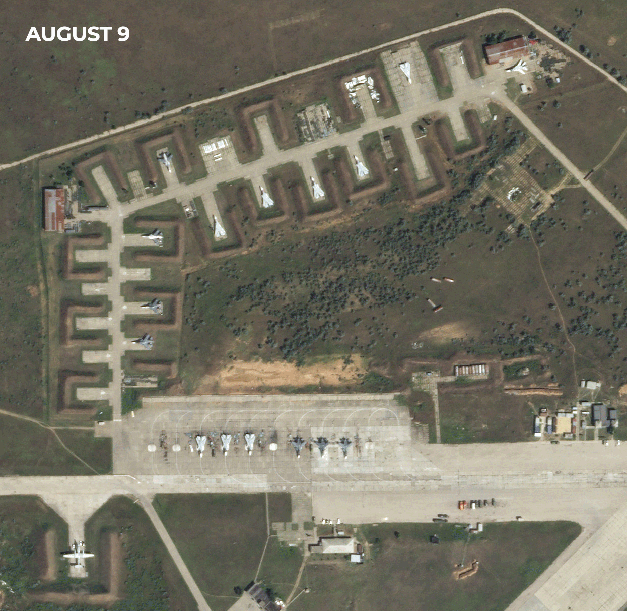 |
SkySat • Saki Air Base, Crimea • August 9 - 10, 2022 |
Many places on Earth are experiencing the effects of severe drought, but The Washington Post reports that the situation in Northern Mexico is nearing an emergency. Climate change and water mismanagement have exacerbated the region’s abnormally dry conditions and substantially reduced its water resources. Yet demand has grown as its population and agricultural activity escalates. Journalists at The Washington Post used satellite imagery to reveal the shrinking of the La Boca reservoir within just a year, and other satellite data from NASA Grace to show that groundwater is nearing record lows in the region. |
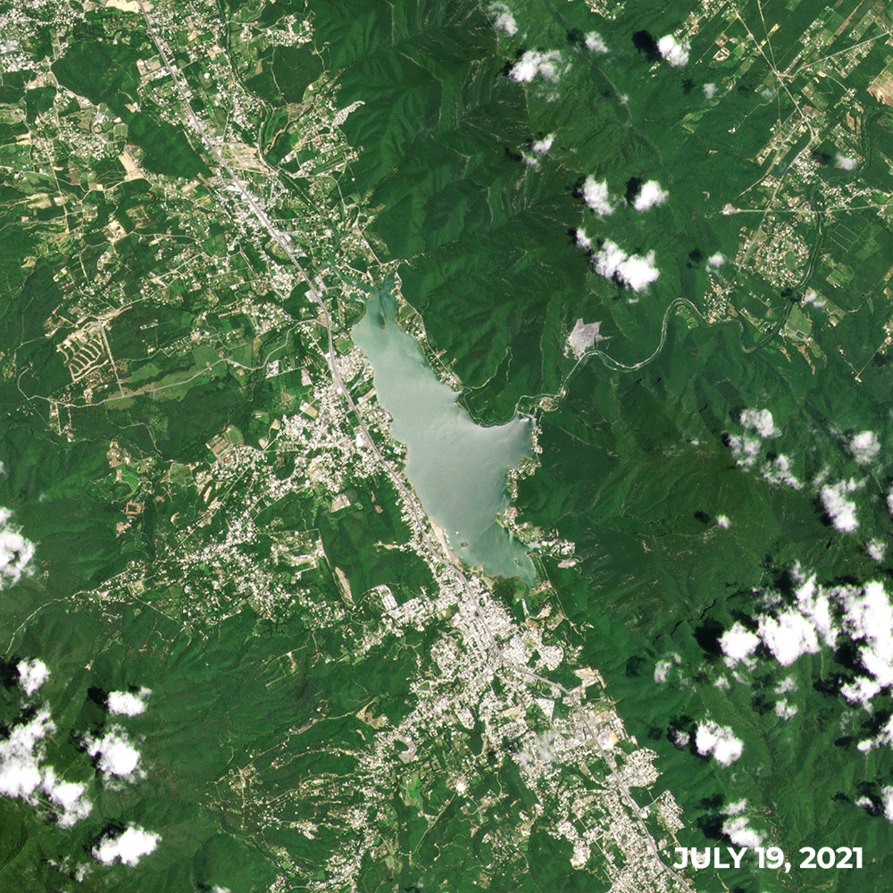 |
PlanetScope • Boca Reservoir, Monterrey, Mexico • July 19, 2021 - July 14, 2022 |
The New York Times used satellite images to identify over 1,200 airstrips that are used to facilitate illegal mining in remote areas of the Amazon rainforest. The resulting deforestation is pushing the rainforest’s health further towards irreversible damage, contributing to climate change, and destroying Indigenous land. The satellite image here shows an illegal airstrip built near the villages of Indigenous people living on protected territory, with mining pits spreading around the area. Not only is deforestation harmful in itself, but the miners use toxic mercury to separate gold from the river’s mud, which pollutes the water and food sources for local communities. |
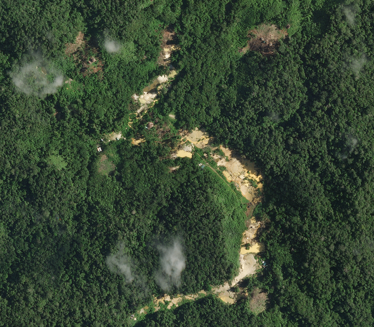 |
SkySat • Mining in Roraima, Brazil • May 6, 2022 |
The Wall Street Journal recently reported on a potential U.S. plan to sanction a network of companies suspected of moving Iranian oil, which has been sanctioned by the U.S. due to stalled nuclear talks. Multiple firms are believed to be skirting the sanction by using ship-to-ship oil transfers to disguise Iranian oil as Iraqi. The Wall Street Journal used satellite images to investigate tankers thought to be involved. |
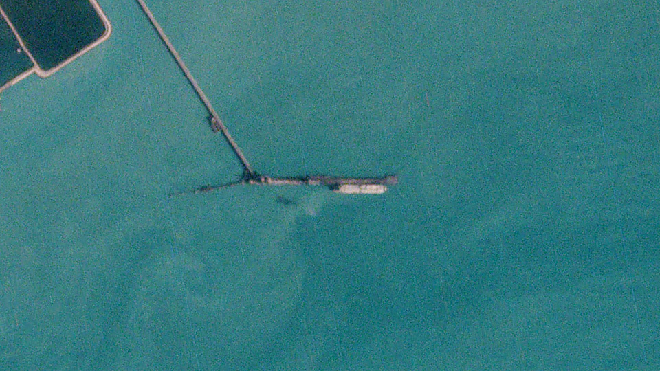 |
PlanetScope • Tanker, Bandar Abbas terminal, Iran • October 3, 2020 |
Europe has experienced a historically hot summer, with multiple capital cities reaching 40-year temperature highs as multiple heat waves roast the continent. The abnormally dry conditions have fueled wildfires that have burned over 500,000 hectares in Portugal, Spain, France, and Greece. The Guardian visualized the severe conditions with graphics showing data from this year’s fires surpassing yearly averages and satellite image timelapses of the fire’s development in certain regions. |
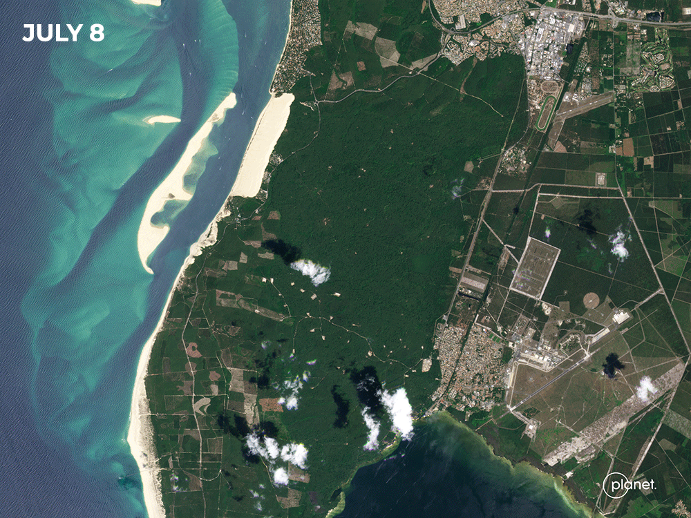 |
PlanetScope • La Teste-de-Buch, France • July 8 - 18, 2022 |
|
|
|
|
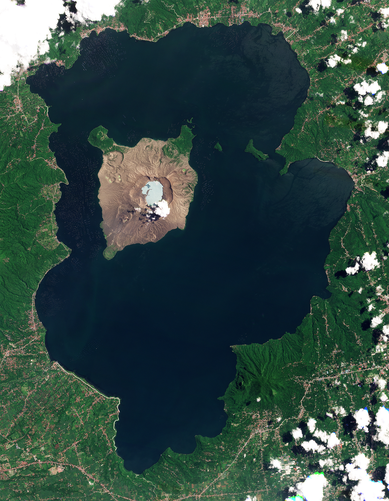
Lakeception
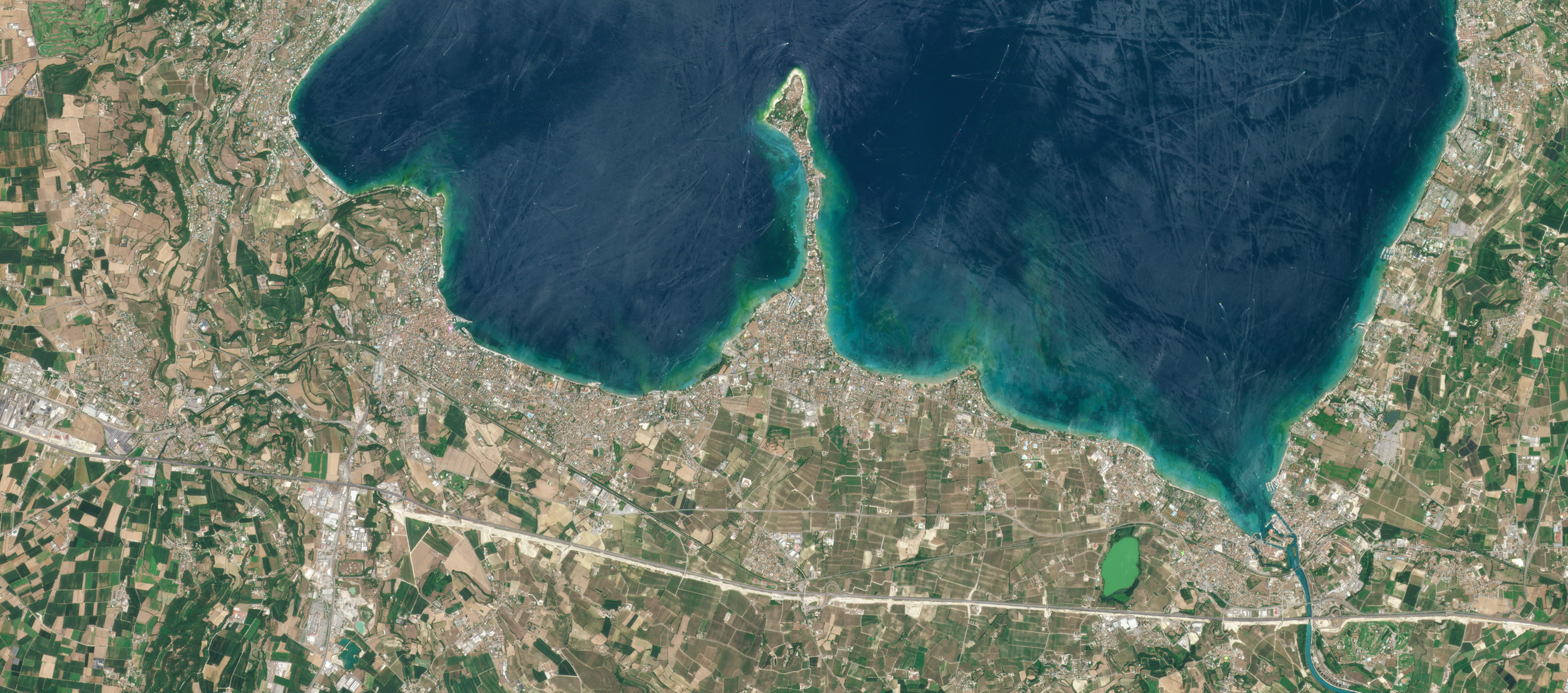
Some places have lakes. Some have islands. Some have both. And others have islands in lakes on islands in lakes on islands. These fun geographic nesting dolls are called recursive islands and lakes. And there are different orders of magnitude to them, starting with simple islands in lakes and spiraling deeper into islands in lakes in islands in lakes, and so forth. |
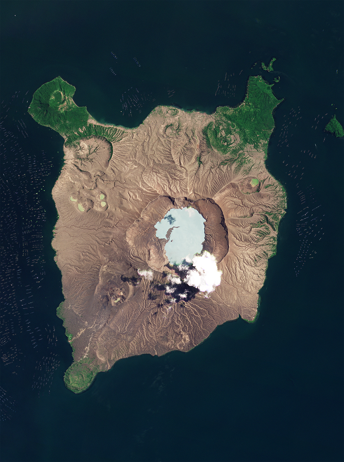 |
PlanetScope • Taal Volcano, Philippines • July 6, 2022 |
Vulcan Point is one of these recursive oddities. It resides in the caldera lake within the deadly Taal Volcano in the Philippines. Zoom out and you’ll notice that Taal Volcano sits in Taal Lake, which is a lake on Luzon island. Making this scenic but lethal volcanic point one of the largest third-order islands.
|
 |
PlanetScope • Taal Volcano, Philippines • July 6, 2022 |
Getting confused with all these islands and lakes? Well strap in for this one, cause this spot in Canada wins the top recursive award: it’s the world’s only island in a lake on an island in a lake on an island in a lake. It’s a mouthful, but we find the oddity pretty neat. |
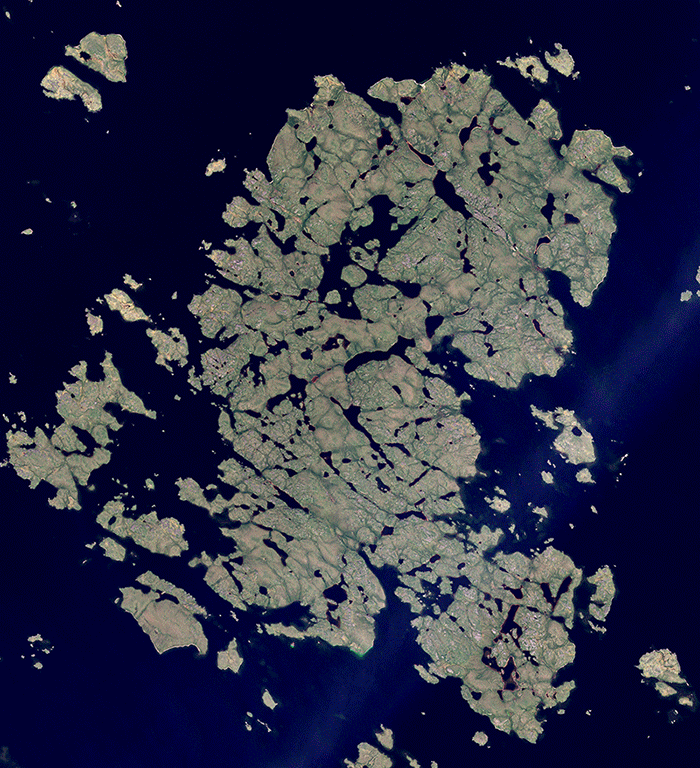 |
PlanetScope • Yathkyed Lake, Nunavut, Canada • July 27, 2022 |
|
|
|
|
|
Tetons Eclipse
No, that’s not the Universal Studios cinematic opening. It’s one of our satellites capturing a solar eclipse over the Grand Tetons. Back in 2017, our team wanted to photograph the North American solar eclipse with a little more panache than, say, just the eclipse’s shadow like we shared a few weeks back. So the team had one of our Doves continuously shoot an image per second at a single point—the Grand Tetons—as it orbited over Wyoming and Idaho during the eclipse. The resulting animation is 100 of those images stitched together as both the satellite and celestial shadow move across Earth’s surface. |
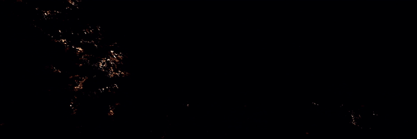 |
PlanetScope • Grand Teton National Park, Wyoming • 2017 |
|
|
|
|
|
|
|
What in the World: Sossusvlei
Towards the southern end of the Namib desert—the oldest in the world—is a stretch of dunes that put the likes of Frank Herbert’s novel Dune to shame. While Sossusvlei might not have giant sand worms, it’s one of Namibia’s most iconic and photographed locations. Its drainage basin doesn’t have outflows, hence its name meaning “dead-end marsh.” |
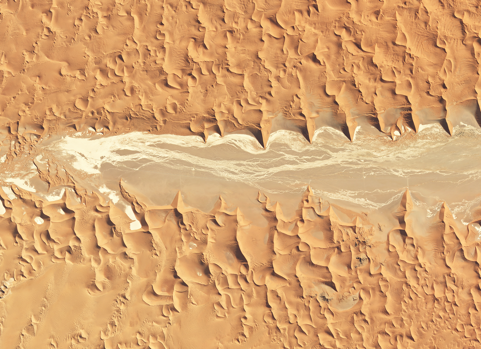 |
PlanetScope • Sossusvlei, Namibia • July 16, 2022 |
|
|
|
|
|
|