
Forestry How-To Webinar Series
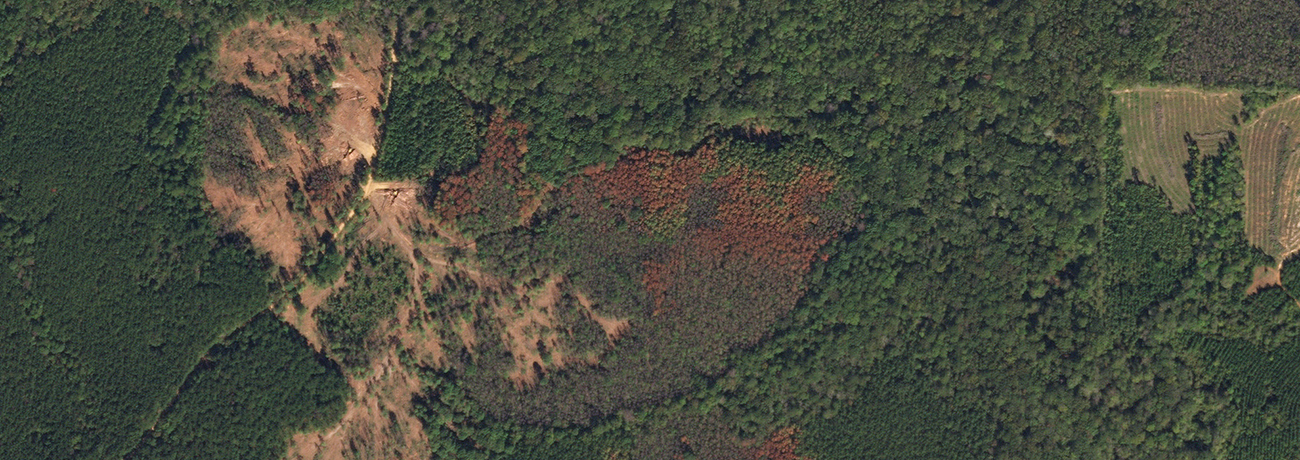
Burn Scar Assessment
Monitoring the impact of disasters using near-daily imagery
In this video we will turn our attention to assessing vegetation disturbances post disaster.
- Leveraging Planet’s high frequency monitoring data and SkySat imagery
- Ingesting this data into Esri’s ArcGIS platform locally
- Executing additional raster operations (BAI) to extract additional insight

Copy — enean lacinia bibendum nulla sedae consectetur. Aenean eu leo quam. Pellentesque ornare sem lacinia quam venenatis vestibulum.
Fusce dapibus, tellus ac cursus codo, tortor mauris condimentum nibh, ut fermentum massa justo sit amet risus.
Aenean lacinia bibendum nulla sed consectetur. Aenean eu leo quam. Pellentesque ornare sem lacinia quam venenatis vestibulum.

LET'S TALK
Contact Us
go.planet.com/getintouch