 |
 |
|
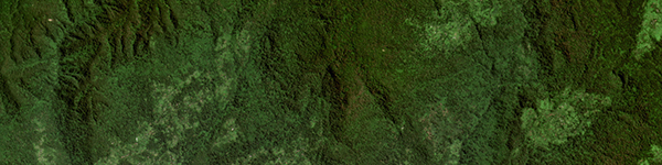
PlanetScope Mosaic • Ethiopia • Q2 2021
|
|
In this week's issue: Satellites monitor deforestation around the world, cliffs and castles are spotted in Ireland, researchers study thermokarst lakes in Alaska, and a fire encroaches on a
nuclear power plant in South Korea.
|
|
|
|
|
FEATURED STORY
Forests Part 2: The Satellite Solution
|
|
This is Part 2 of our special feature for International Day of Forests on March
21st.
Check out last week's issue about the problem of deforestation if you haven't already, and read on for a look at how satellites are helping the global community
fight back.
Green corresponds to the wavelength near the middle of our visible spectrum, so we see more shades of it than any other color.
This ability helped our ancient ancestors scavenge food in forested regions.
But there's less green in the world now.
And most of us don't need our eyes to discern lunch from the background environment.
The challenge has changed.
What we need now is an eyesight adapted to spotting how the environment is changing itself.
|
 |
|
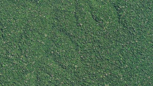
SkySat • Brazil • September 12, 2021
|
|
Forests are indispensable to life on Earth.
Without them we wouldn't be here.
But over the centuries deforestation has run rampant, harming biodiversity and jeopardizing our ability to combat climate change.
There are fewer trees now than there were back then.
And it's essential for us to know how many trees we're losing and where we're losing them.
But here lies the problem within the problem: existing databases are inadequate and often contradictory.
There are an estimated 3 trillion trees on Earth.
Relying on governments and organizations to keep a tally on that many trees across an entire planet is nearly impossible without advanced technology.
Here's where satellites thrive.
|
 |
|
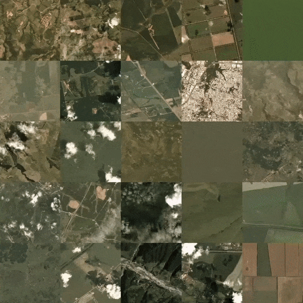
Selection of forest images captured by Doves in a single day
|
|
At a broad data collection scale, satellites are incredibly effective.
They can survey large swaths of the globe and record what they see.
And some like Landsats have been doing it for decades.
More recent constellations, however, are able to work in near real-time.
These satellites can be used to create global datasets that are updated frequently, providing a more precise account of how many trees there are and how fast they're being lost.
Governments and global initiatives can then use this monitoring to crack down on the illegal activity they find.
|
 |
|
PlanetScope • Adolfo Ducke Forest Reserve, Brazil • November 5, 2021
|
|
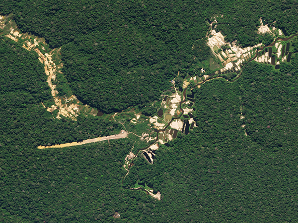
Satellites can't find a needle in a haystack, but they can spot an errant clearing in a dense forest.
Illegal deforesters have thrived for decades in the sanctuary of remote locations.
But it can actually be easier for researchers to locate
deforestation in more isolated places via satellite.
Different deforestation activities mark the landscape in distinct ways, like the open pits and runway spotted in this small-scale gold mine.
Various organizations will alert authorities once illegal operations like these are flagged, helping shut down operations as early as possible.
How's remote sensing foiling remote logging for poetic justice?
|
 |
|
SkySat • Pará, Brazil • June 5, 2021
|
|
The bad news is that we're still losing forest cover.
The good news is that we're losing less of it than we were before.
NASA reports that Earth is literally greener than it was 20 years ago—largely due to vegetation growth in
India and China.
The increase in leaf area this represents is equal to an area roughly the size of all the Amazon's rainforests.
And tree planting has become a popular way to support climate initiatives, with billions of trees planted in 2021 alone.
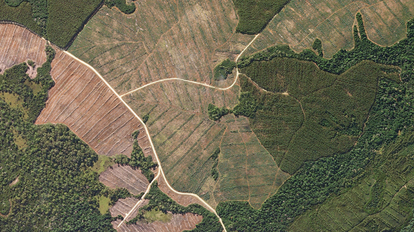
The visual perspective: Trees are seen in at least 4 different stages of growth at this timber farm in Tasmania.
|
 |
|
SkySat • Tasmania, Australia • March 30, 2019
|
|
Of course, data collection without action is about as useful as a bookie without henchmen.
It's ultimately up to how serious governments are about their deforestation policies.
But a number of initiatives are acting on satellite data with tangible results.
The MAAP team uses satellites to spot deforestation and alert authorities.
Then they use satellites to watch how effective that government's action was.
Others like NICFI and Global Forest Watch allow users to monitor the planet's forests in real-time.
And there's evidence that governments around the world are increasingly committed to reversing deforestation trends.
The UN reports that roughly 726 million hectares of forest are now protected, which is 200 million more than in 1990.
|
 |
|
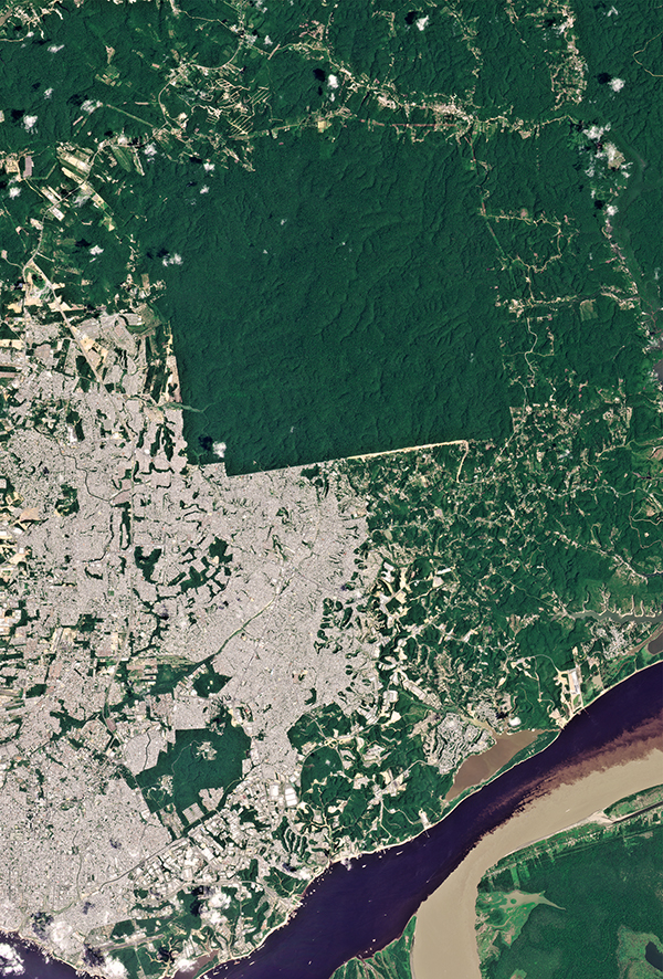
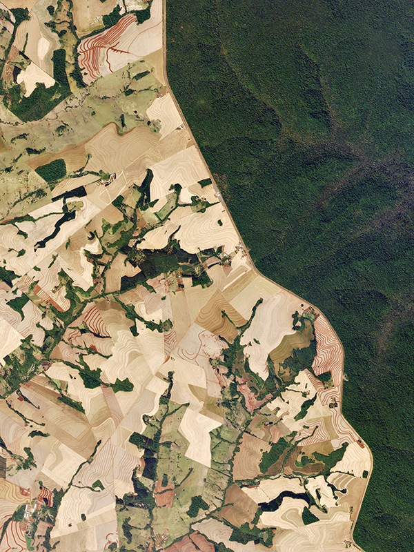
PlanetScope • Iguazú National Park, Brazil • September 23, 2016
|
|
|
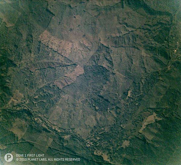
This issue is near and dear to our heart.
When Planet's first satellite launched in 2013, our founders' original idea was to count every tree on Earth—all 3 trillion of them.
It just so happens that the first image taken by Dove 1 was of a region in Oregon containing, well, pretty much only trees.
Tracking deforestation and equipping forest managers with real-time data continues to be core to our mission.
And we're always excited to share great tree imagery, so stay tuned for more from us in the future.
Learn more about forest and land use by satellite monitoring on our website.
|
 |
|
PlanetScope • Oregon, USA • 2013
|
|
|
|
Saint Patrick's Day
|
|
Maybe you're tired of looking at the color green.
But in the wise words of Kermit the Frog, "It's not easy bein' green." So bear through it a little longer if you will.
It's Saint Patrick's Day, after all.
To celebrate the primary patron saint of Ireland we wanted to share some new sights of the country.
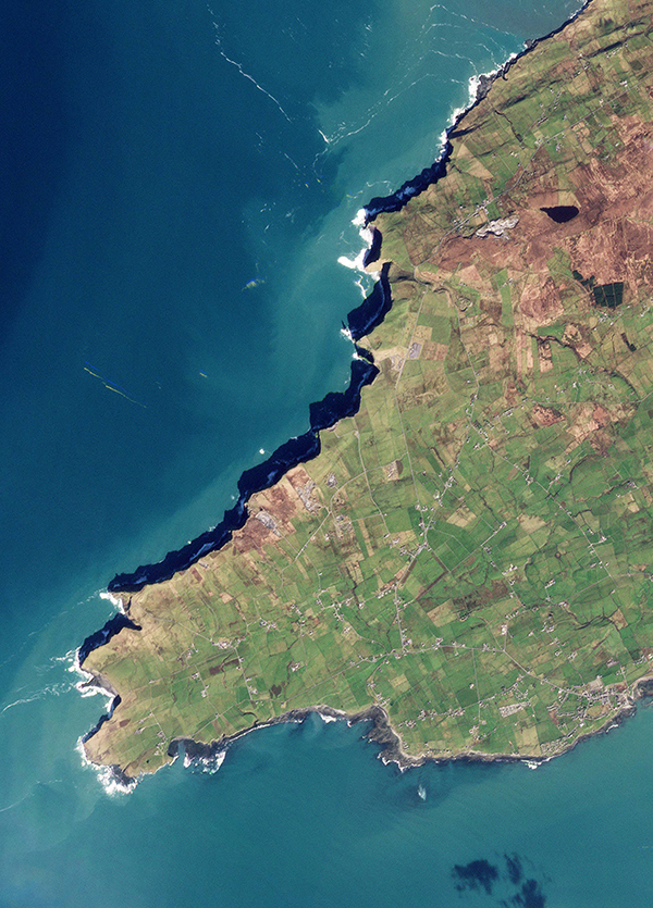
We can't spot shamrocks from space, but we can see giant cliffs and castles.
The Cliffs of Moher cast striking shadows along 14 km (8.7 miles) of the island's rocky western shores.
|
 |
|
PlanetScope • Cliffs of Moher, Ireland • March 6, 2022
|
|
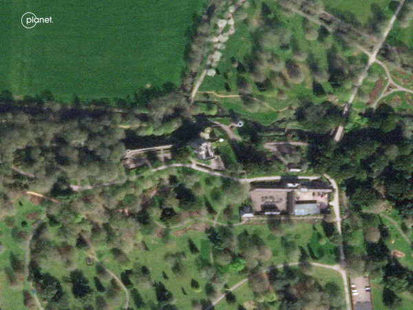
The legendary Blarney Stone can be found in Ireland's Blarney Castle (and in the names of pubs across the world).
When the stone is kissed, it is said to give the kisser the gift of eloquence and flattery.
|
 |
|
SkySat • Blarney Castle, Ireland • April 2, 2021
|
|
|
|
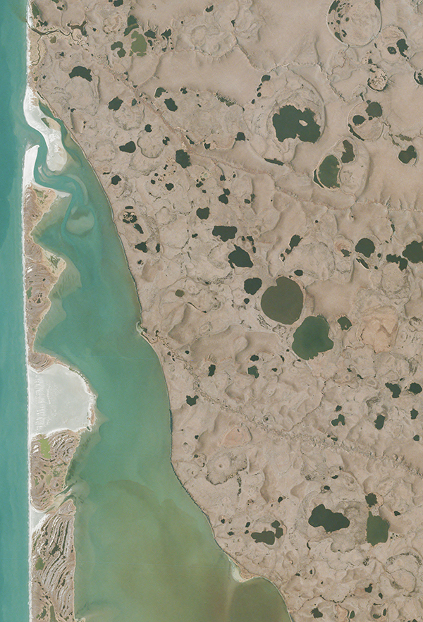
Thermokarst Lakes
|
 |
|
PlanetScope • Bering Land Bridge, Alaska • September 27, 2017
|
|
What happens when permafrost thaws? Expulsion of greenhouse gases that contribute to global warming positive feedback loops.
So, bad news, mostly.
But they also leave behind otherworldly-looking thermokarst lakes, like the ones shown here in Alaska's Bering Land Bridge National Preserve.
Researchers used Planet data to study these lakes as they drained between 2017 and 2018.
Read more about their research here.
|
|
|
|
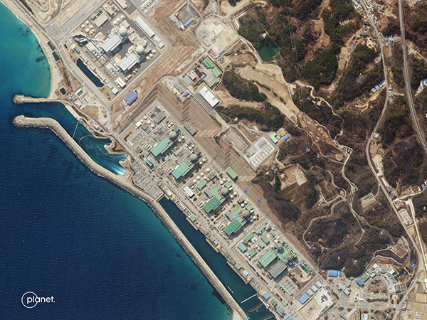
Fires and Nuclear Reactors
|
|
What does an image of the phrase "close call" look like? Probably something like this.
A natural disaster alert was issued in South Korea after a wildfire ignited near the Hanul Nuclear Power
Plant in Uljin County.
This image shows the power plant on March 9th after the fires had subsided.
Its burn scars can be seen in grey near the lower right corner of the image.
|
 |
|
SkySat • Hanul Nuclear Power Plant, South Korea • March 9, 2022
|
|
|
|
|
|
|