Planet Snapshots
DECEMBER 16, 2021
Issue #6
|
 |
|
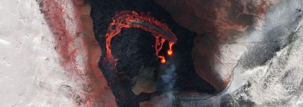
SkySat image of Fagradalsfjall volcano, Iceland, March 26, 2021.
|
|
In this week’s issue: A look back on the satellite images that helped shape the news this year.
News cycle, meet satellite orbit.
Quick note: Snapshots will be off for the next 2 issues but catch us in 2022. We hope you enjoy the holidays!
At this point it comes as no surprise that 2021 has been an eventful year for newsrooms around the world.
From geopolitical conflict to natural disasters to strange stories, like the crypto-trading hamster that outperformed Warren Buffett
(RIP Mr.
Goxx), 2021 really had it all.
The best and most accurate news articles synthesize multiple perspectives to produce accessible and exciting stories.
What better way to do that than to pair on-the-ground-reporting with eyes in the sky? Satellite imagery empowers journalists to monitor events in real-time, illustrate scenes from unique perspectives, and analyze events in detail.
Here are our favorite uses of satellite imagery in news stories this year!
|
|
|
|
|
January
|
 |
|
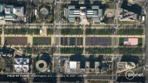
SkySat image of Field of Flags, Washington, D.C., January 19, 2021.
|
|
The world saw a shift in the American political landscape as a new U.S.
president took office amidst the coronavirus pandemic.
During President Biden’s inauguration, the National Mall in Washington D.C.
was lined by a “field of flags” in place of the usual crowds.
Satellites captured the almost 200,000 flags that were planted for the event and demonstrated that in great enough numbers, even the small can be seen from space.
|
|
|
|
February
|
 |
|
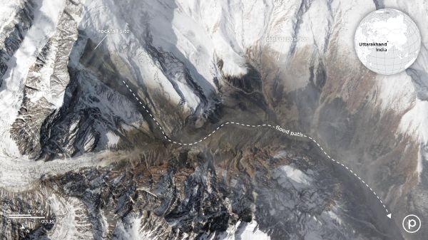
SkySat image of avalanche in the Indian Himalayas, February 9, 2021.
|
|
On February 7, bright sunshine followed heavy snowfall to create a deadly avalanche in the Indian Himalayas.
Reporters at Reuters merged satellite imagery with 3D models to recreate and analyze what happened.
The aerial perspective revealed details formerly unknown to researchers, like the site of the rockfall and the extent of the landslide’s dust plumes.
Take a look at the article for more detailed graphics.
|
|
|
|
March
|
 |
|
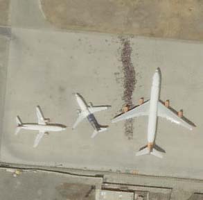
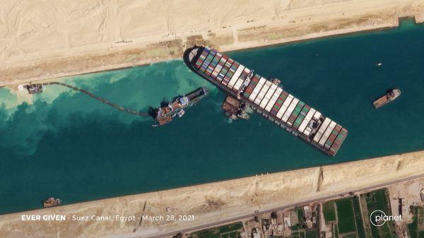
SkySat image of Ever Given stuck in the Suez Canal, March 28, 2021.
|
|
Hopefully you’ve never made a mistake so bad it can be seen from space.
In March, Ever Given, a quarter-mile long container ship, got stuck in the Suez Canal for 5 days.
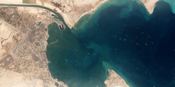
USA Today used satellite imagery to show the ship blocking the narrow passageway and the backlog of ships in the
gulf waiting for the situation to clear.
|
 |
|
PlanetScope image of container ships waiting in the Suez Canal, March 25, 2021.
|
|
|
|
JUNE
|
 |
|
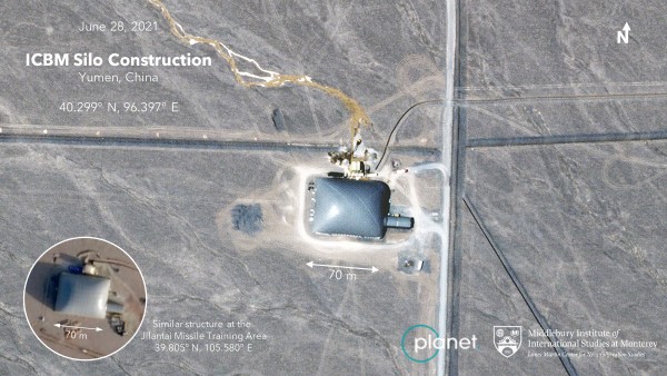
Satellite imagery captured by Planet with annotated analysis by MIIS.
|
|
Analysts at Middlebury Institute of International Studies at Monterey (MIIS) used Planet satellite imagery to identify the construction of 119 missile silos near Yumen, China.
The Washington Post reports that this signals a substantial growth in China’s nuclear
arsenal.
|
 |
|
Planetscope image the silos’ network in Yumen, China, June 24, 2021.
|
|
|
|
July
|
 |
|
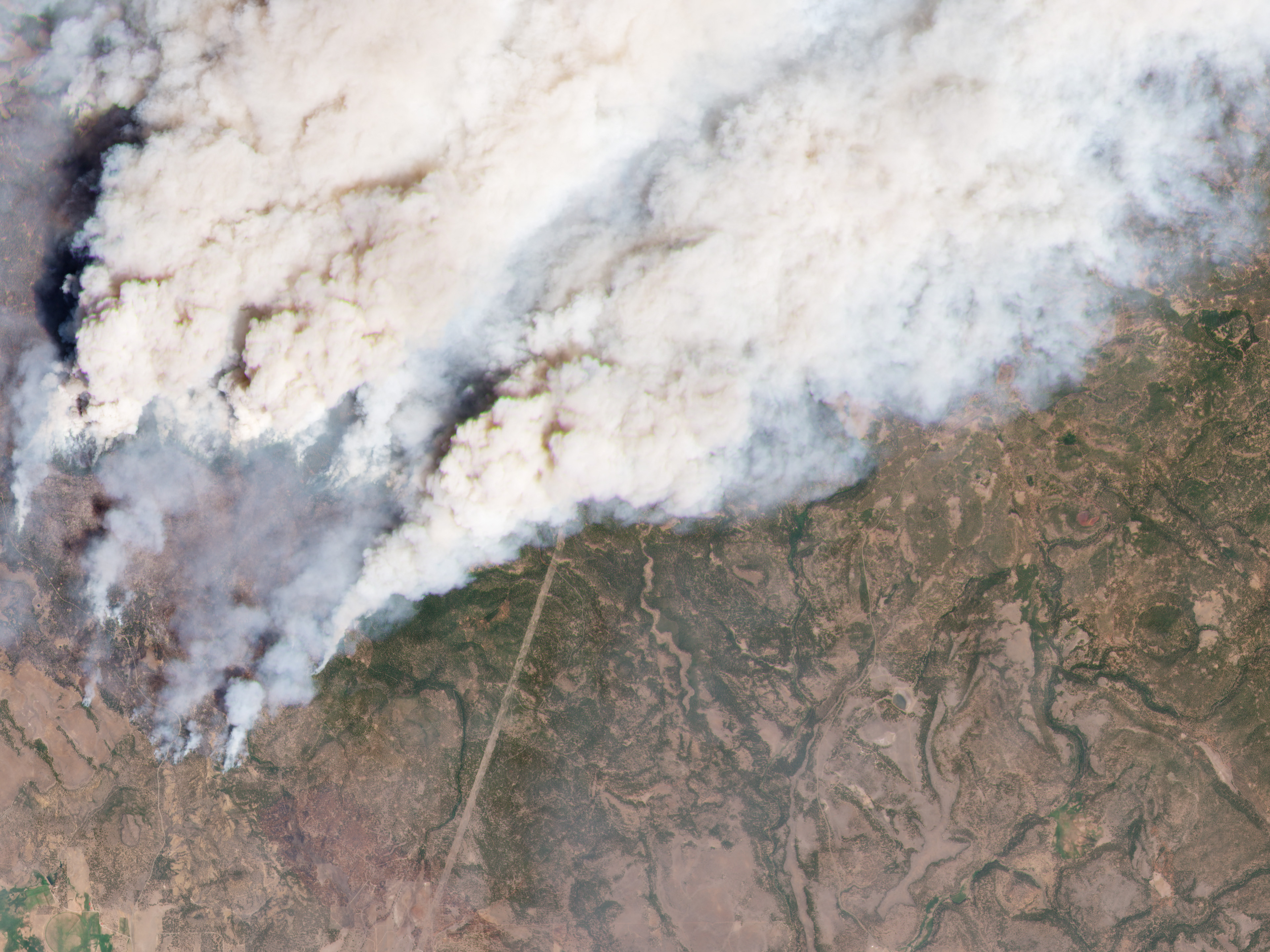
PlanetScope image of the Bootleg Fire, Oregon, July 9, 2021.
|
|
Left high and dry: Smoke plumes billow from the Bootleg Fire in Oregon this July.
KQED reports on the West’s historic drought and the compounding climate consequences it is creating for the region.
Wildfires are an acutely visual display of drought and they look particularly haunting from space.
We spend a lot of time looking, talking, and writing about drought, so head over to our drought page if you want to learn more about how satellite imagery is helping us understand this
issue.
|
|
|
|
AUGUST
|
 |
|
|
|
|
|
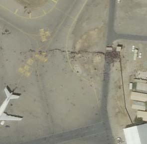
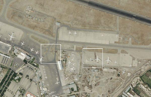
SkySat image of crowds forming at Kabul Airport, Afghanistan, August 16, 2021.
|
|
In August, U.S.
forces pulled out of Afghanistan as Taliban fighters closed around the last stronghold of Kabul.
The airport became a central point of the retreat as citizens crowded the gates trying to flee and Taliban attacked entrances.
The New York Times and The Washington Post used satellite imagery to map out and describe the mayhem.
|
|
|
|
SEPTEMBER
|
 |
|
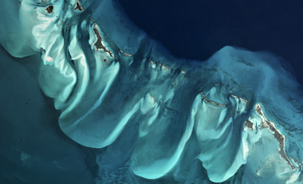
PlanetScope image of The Bahamas.
|
|
In September, outlets like The Associated Press covered the Allen Coral Atlas, the first-ever global, high-resolution map of the world’s shallow tropical coral reefs.
The new mapping platform combines satellite and scientific data to help monitor and protect this threatened ecosystem.
As of November, almost 50 new marine planning projects are using the Atlas maps as a primary dataset across 14 countries.
The Philippines is using the data in an effort to protect 30 million hectares of marine areas by 2030.
Like the open seas, It’s open-access, so go check it out for yourself.
|
|
|
|
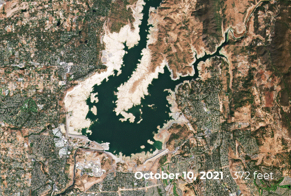
OCTOBER
|
 |
|
PlanetScope images of Folsom Lake.
|
|
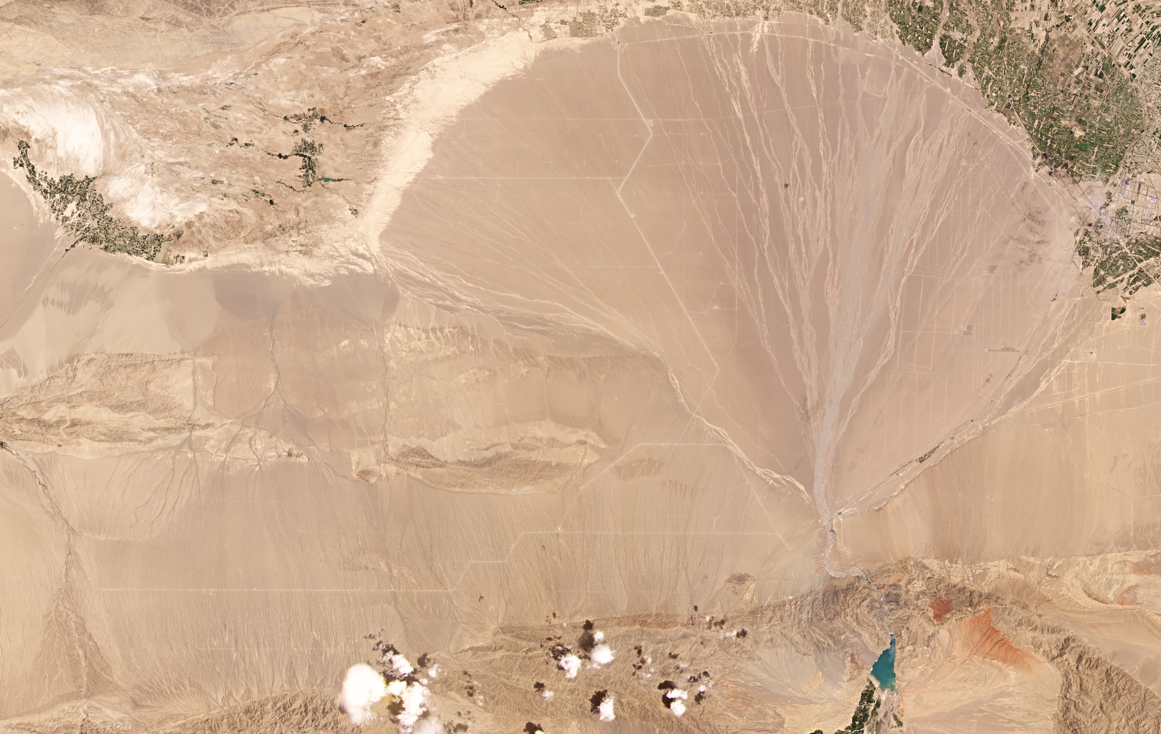
Some ski resorts opened weeks ahead of schedule this season after an atmospheric river storm brought 8 trillions tons of rain and snow to California in late October.
The Washington Post used satellite images of Folsom Lake to show how reservoirs in the area rebounded in the wake of the
downfall.
The water was a relief for the drought-stricken state but not nearly enough to reverse the years of drying conditions.
|
|
|
|
|
|
|