Planet Snapshots
NOVEMBER 4,2021
Issue #1
|
 |
|
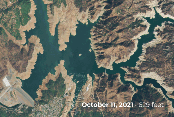
PlanetScope image of Lake Oroville.
|
|
Welcome to Planet Snapshots! We’re thrilled you’re here and we’re excited to bring you this first week’s collection of images and stories sourced from our orbit.
As a part of the Snapshots community we’d love to hear from you, so please get in touch and let us know how we’re doing.
Ad astra!
In this week’s issue: torrential rains raise reservoirs, ghost ships emerge from the deep, air domes cover missile silos, and fall foliage seen from above.
|
|
|
|
|
FEATURE STORY
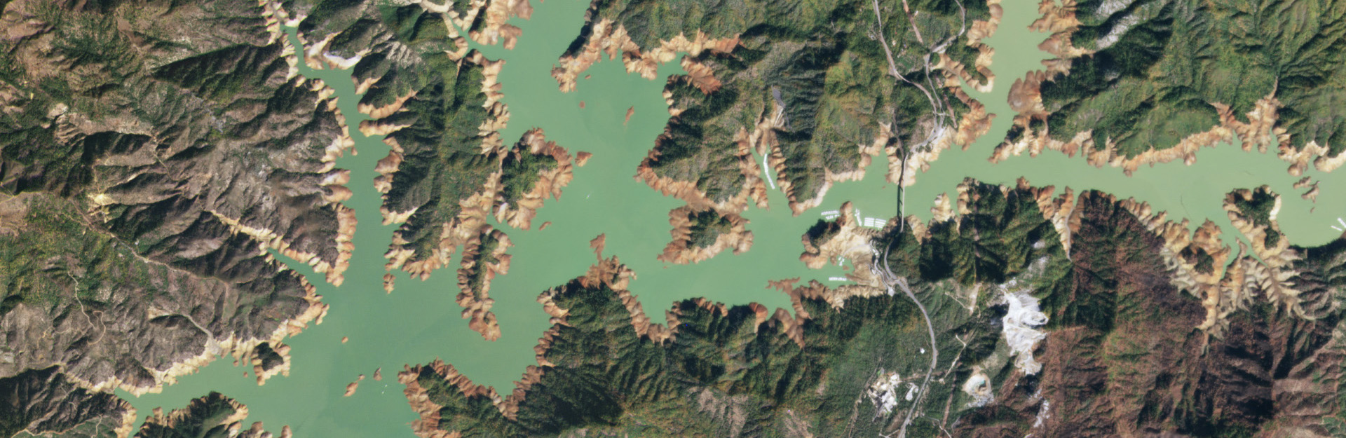
Rebounding Reservoirs
Avid skiers rejoiced as some ski resorts opened weeks ahead of schedule.
The news arrived after an atmospheric river storm brought 8 trillion tons of rain and snow to California on October 24th and 25th,
drenching the drought-stricken and fire-prone state in record numbers.
|
 |
|
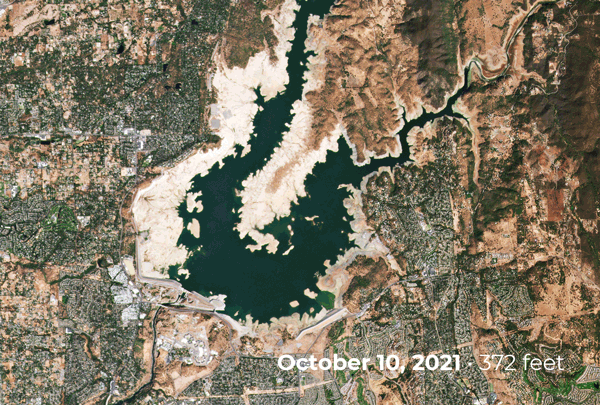
PlanetScope images of Folsom Lake.
|
|
But its benefits go beyond just an earlier ski season.
The deluge helped alleviate dry conditions that have caused the state to experience one of its worst fire seasons yet and multiple reservoirs received a much needed influx of water.
Many are still below their historical average but it’s a promising sign with the wet season still ahead.
After the clouds cleared, we monitored key reservoirs to see how they compared to prior months when many dipped to record lows.
The steady declines in elevation were interrupted by a sharp rebound after the storm, with Folsom Lake rising by about 16 feet and Lake Oroville by 30 feet.
|
 |
|
PlanetScope images of Lake Oroville
|
|
Unfortunately, a single storm is not enough to relieve the years of drought-related conditions impacting the state, but it’s an encouraging start.
|
|
|
|
|
|
|
|
|
|
|
|
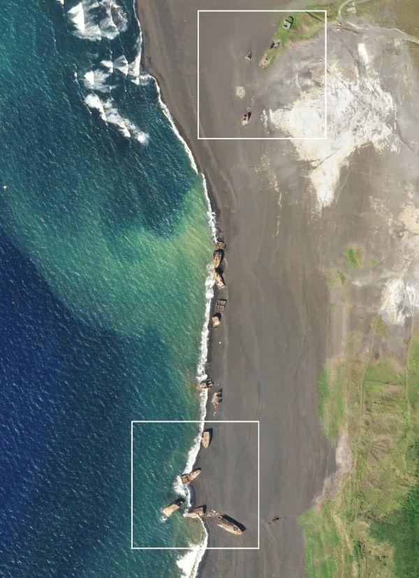
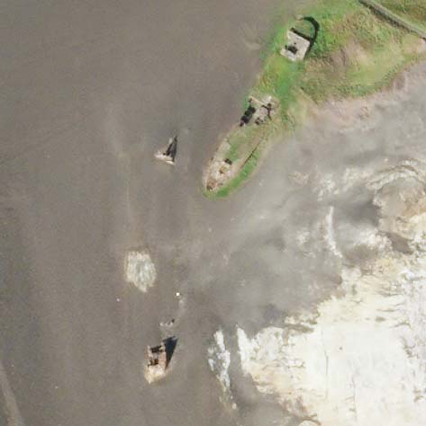
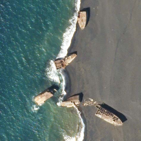
SkySat images of World War II shipwrecks, Iwo Jima, October 22, 2021.
|
|
Not all that’s sunk is forgotten: In mid-October seismic tremors further uncovered World War II relics near the island of Iwo Jima.
Two dozen Japanese transport ships that were submerged in the 1940s by U.S.
forces to create breakwater for a harbor are now located on the beach.
As underwater volcanoes raise the seabed surrounding the island, areas formerly underwater—and the artifacts found there—emerge from the deep.
Read more about the ships’ history and view historical satellite images in The Drive’s article.
|
|
|
|
|
Inflating Nuclear Tensions
|
 |
|
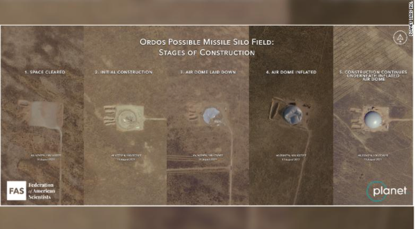
FAS analysis of Planet data on Chinese missile silos.
|
|
Something's astir in the desert! For the third time this year, researchers have identified a sprawling expanse of roads and construction in China’s western desert.
Seemingly, this development has sprung up in just a matter of months and experts believe the work is China's latest effort to expand its global defense capabilities.
Analysts at FAS identified the construction of air domes—close in size to a football stadium—over the silos to protect them from environmental conditions and possibly to prevent satellite surveillance.
While the missile silos represent a concerning shift in geopolitical relations, we can’t help but notice their resemblance to a bounce house!
|
|
|
|
|
Changing Earth
|
 |
|
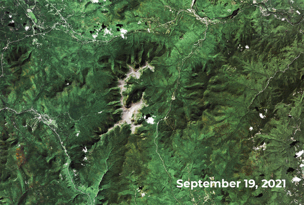
PlanetScope images of the Presidential Range, New Hampshire.
|
|
Our Doves took the scenic route over New Hampshire’s fall foliage to peep the colors of the changing leaves this year.
The most dramatic variations can be seen among the deciduous trees by the range’s lower elevation, while the evergreen forests higher up stay, true to their name, mostly green.
While some may prefer a drive down Kancamagus Highway, we prefer the aerial view!
|
|
|
|
|
Instagram Highlight
|
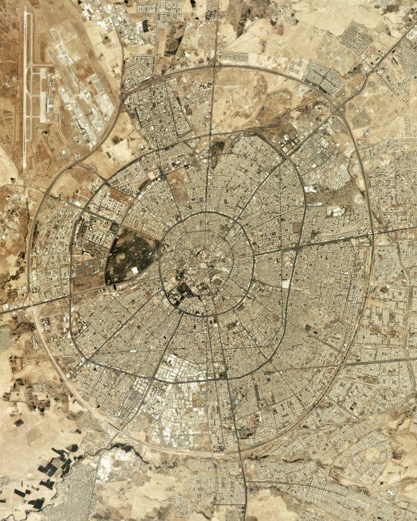 |
|
Created by Overview, source imagery from Planet
|
|
@dailyoverview created this mesmerizing image using Planet’s data of Erbil in Iraq’s Kurdistan Region, where concentric roads emanate from the Citadel of Erbil in the city’s center.
|
|
|
|
|
In the News
- Counting tusks: Research from USGS in Alaska suggests that satellite surveillance could provide a powerful method for tracking groups of walrus whose habitat is threatened by melting sea ice.
- ML eyes in the sky: Quartz reports on Climate TRACE, a coalition pairing machine learning and satellite imagery to track the source of greenhouse gas emissions.
- Watching climate change: Politico writes about the importance of satellite technology in measuring the consequences of climate change and the effectiveness of policies designed to combat it.
|
|
|
|
|