|
|
|
|
|
|
|
|
|
|
 |
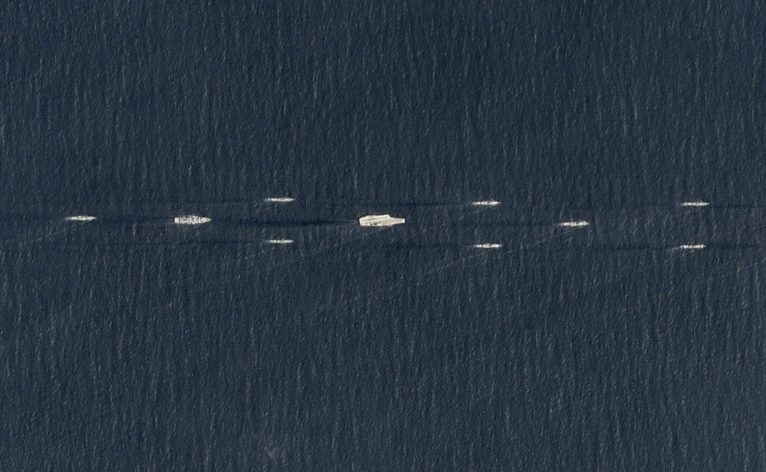 |
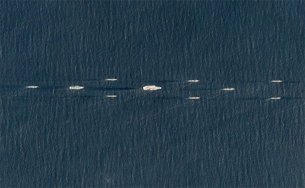
PlanetScope • People’s Liberation Army Navy Exercises • April 1, 2018 |
In this week’s issue:
Having trouble viewing images? Then read this issue on Medium! |
|
|
|
|
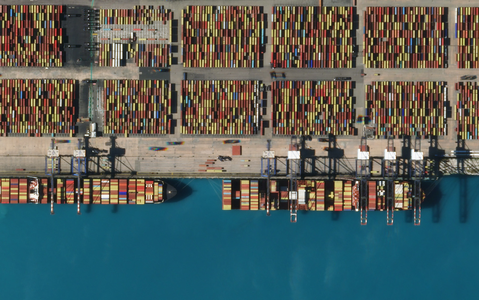
FEATURE STORYVessel Detection
We use the idiom “needle in a haystack” to describe the difficulty of finding an object, but a more apt phrase would be “ship in the ocean.” Because if finding a needle is hard, then finding any given ship is nearly impossible. Like the dark web, it is vast, interconnected, and largely unregulated—the perfect location for illicit activity. But new technologies are shrinking the seas and acting as modern lighthouses by helping authorities detect ships and shining a light on unlawful practices.
Most maritime domain awareness (MDA) literature has about as much lingo as a pirate and the pacing of Moby-Dick. And yet it’s one of the most exciting fields of monitoring research. Part of the wind behind its sails is the combination of AI and satellite data that enables experts to sift key insights from the ocean’s monotonous blue sprawl. And a burgeoning group of open-source researchers, reporters, and officials are wading into these murky waters to demystify this game-changing combo.
|
 |
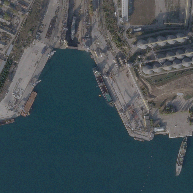 |
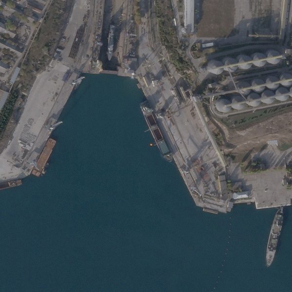
SkySat • Port of Sevastopol, Russian-occupied Crimea • April 2022 - March 2023 |
Here’s the problem in a nutshell: Earth’s oceans are so expansive, vital, and undivided that, like Antarctica and the Moon, no one owns them (besides the 200 nautical miles extending from a country’s coastlines). Yet at the same time regulation is necessary. So global powers made an international coalition to help manage this common-pool resource. But like so many tragedies of the commons, the ocean’s laws are hard to enforce and its limits tend to be exploited. |
 |
 |
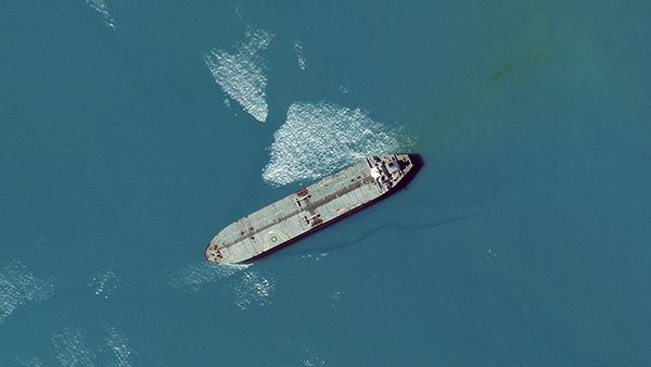
SkySat • Ship in the Strait of Hormuz, Iran • May 6, 2023 |
As canoes turned to titanic supertankers and the global number of vessels proliferated, more sophisticated measures for monitoring maritime activity were needed. So nautical experts developed a complex automatic identification system (AIS) to transmit a boat’s location data and allow authorities to map the network of ships moving across the globe. But a ship can unplug from this monitoring system simply by turning off its transponder in an act called “dark shipping.” |
 |
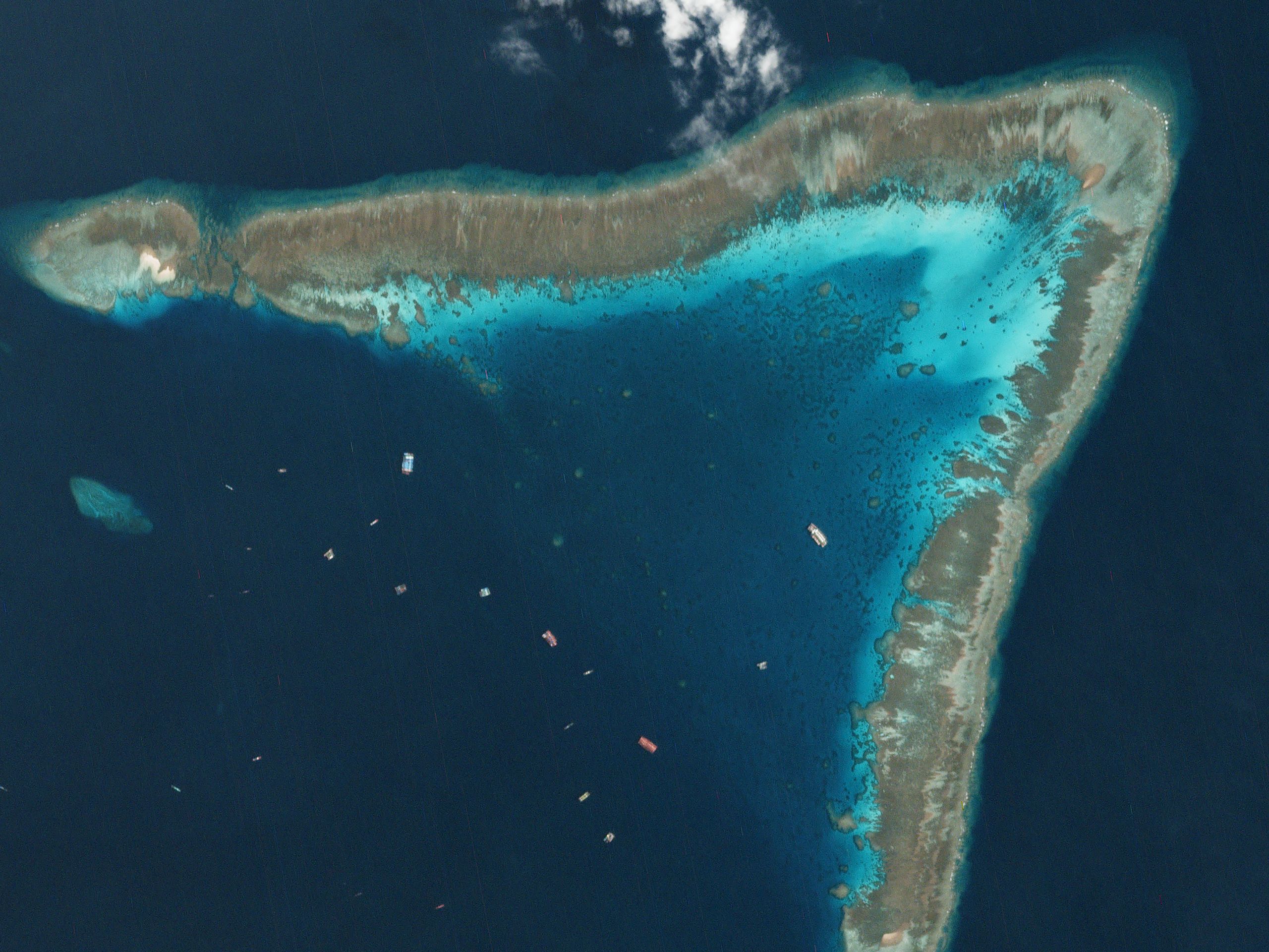 |
PlanetScope • Ships sheltering in the contested Whitsun Reef, South China Sea • September 22, 2020 |
With this global surveillance program in mind, you’d think that ships going dark is riskier than using a semicolon in a newsletter without an English degree; and yet both are happening with alarming frequency. For the sailors and companies that own the ships, rewards for going dark often outweigh the risk, like fishing opportunities in protected waters or supplying high-value cargo to sanctioned countries like North Korea. |
 |
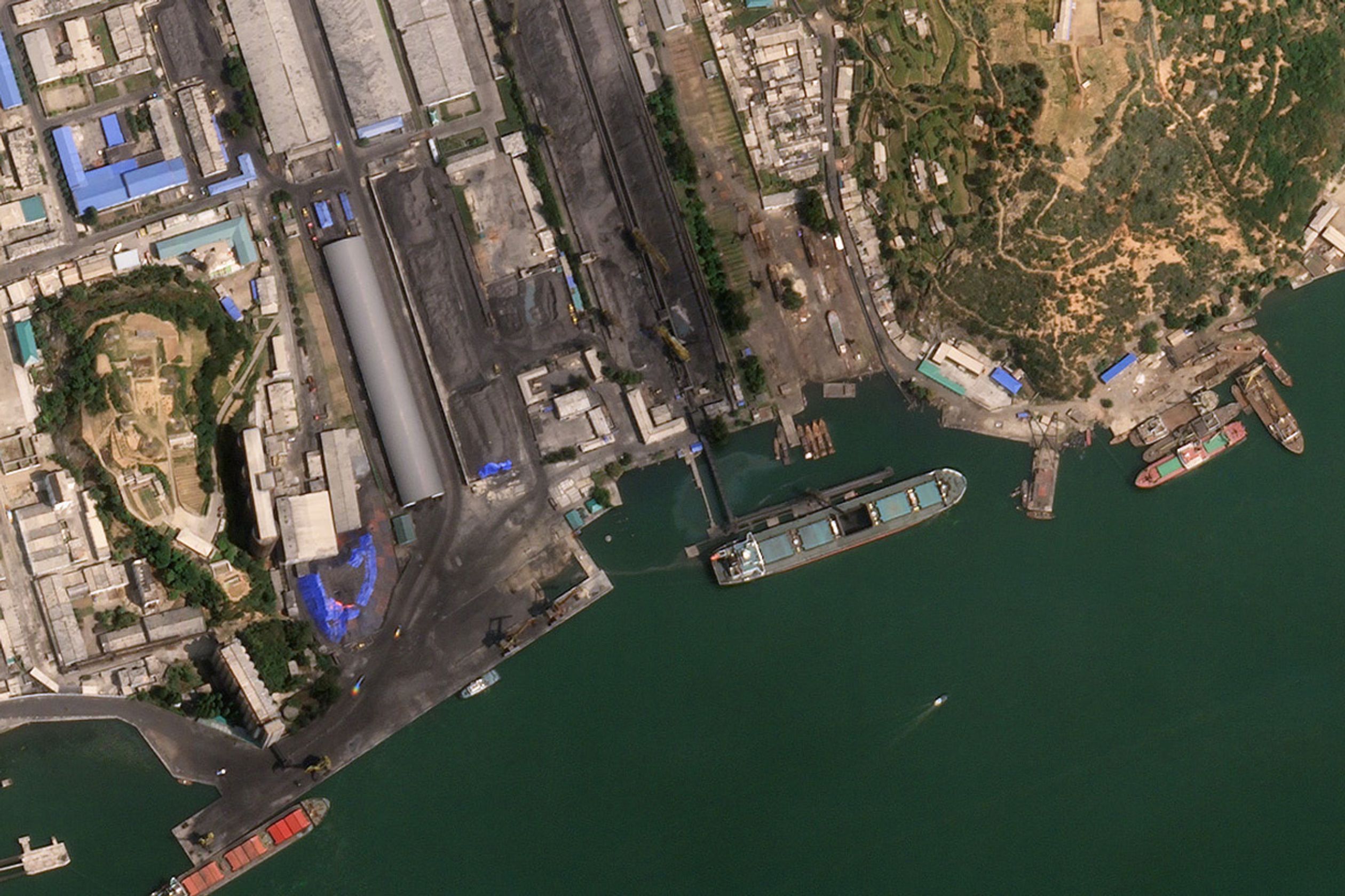 |
SkySat • Bai Mei 8 loading coal at the Nampo Harbour, North Korea • July 6, 2017 |
Vessels engaging in illicit activity often turn their transponders on-and-off to avoid detection: appearing like fireflies in a dark forest, popping up for a flash in one location, then moments later in another. Or they send a fake location, called “spoofing.” That’s what one tanker did earlier this year when it pretended to be near Japan when it was actually transporting oil from Russia to China in violation of US sanctions. The reporters at The New York Times who broke the story turned to space and satellites to outwit the spoofers. |
 |
 |
PlanetScope • Cathay Phoenix at Kozmino port, Russia • February 2023 |
Here’s how it works: satellites are capturing extensive data over key marine areas. This is the tremendous pile of hay we have to work with. But parsing through this data can be laborious, if not impossible. In the months following Russia’s invasion of Ukraine, multiple reporters chased where all of the country’s stolen grain went. The investigators identified ships in the Port of Sevastopol in occupied Crimea by comparing satellite imagery with social media posts and ship-tracking data—an effective, but arduous process. |
 |
|
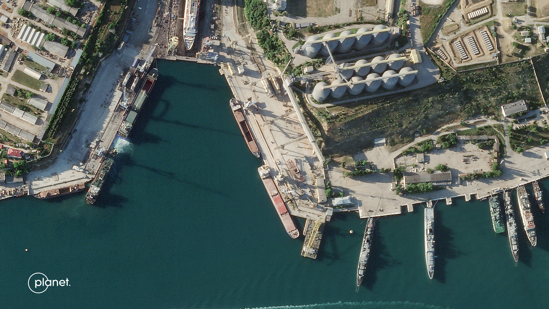 |
SkySat • Ships near grain terminal in the Port of Sevastopol, Russian-occupied Crimea • June 5, 2022 |
Uprooting the shadowy underground networks that facilitate illicit activity is made more difficult by their wheelhouse of evasive maneuvers: shell companies, cargo laundering, and falsified documents. But in this arms race of deception and detection, maritime monitors may have achieved the upper hand with the introduction of AI. When paired with satellite and AIS data, AI can not only tell you exactly where the needle is, but also what it looks like and where it’s been on its journey through the haystack. |
 |
|
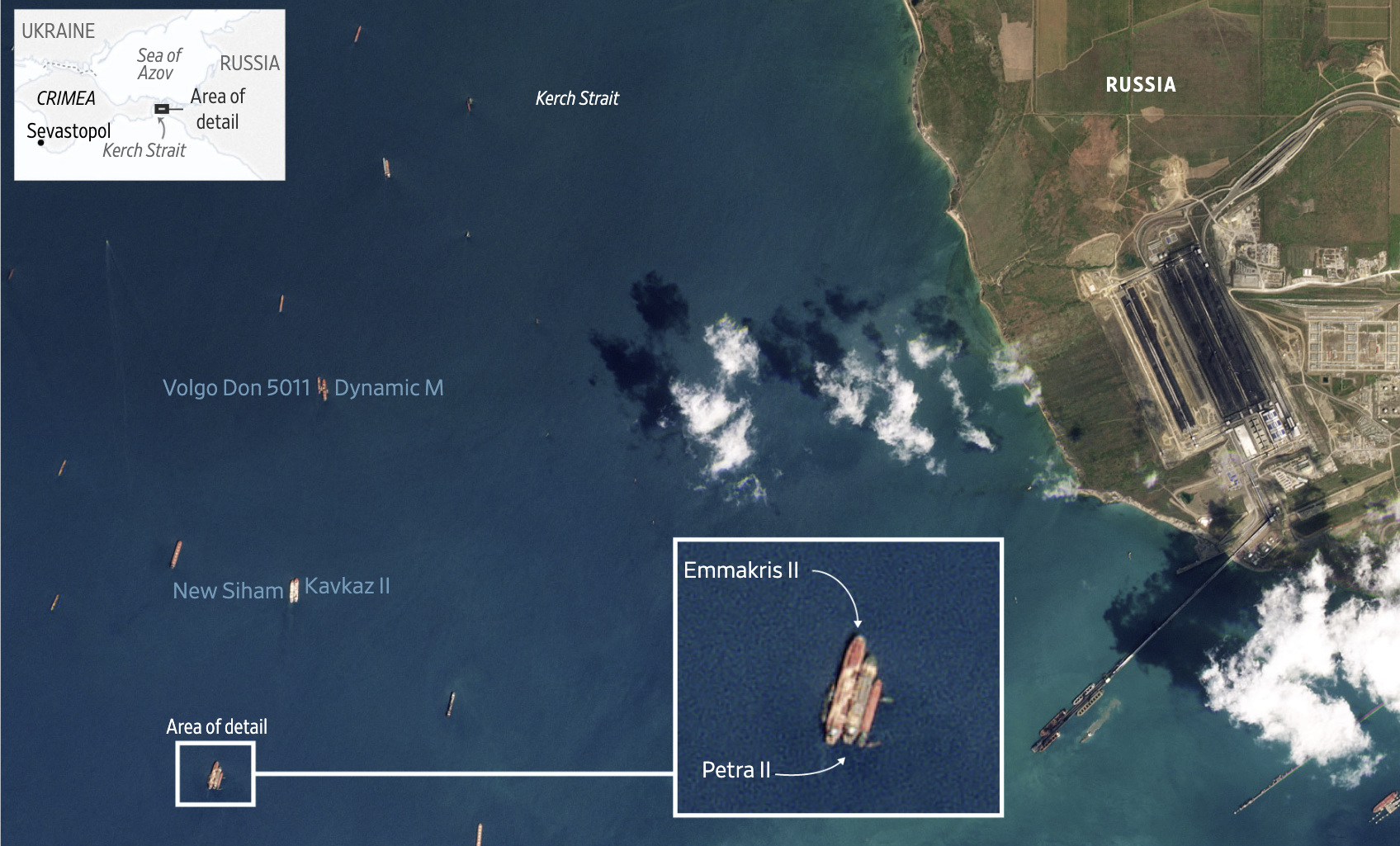
PlanetScope data, analysis by The Wall Street Journal • Russian-linked vessels reportedly transporting stolen Ukrainian grain • June 11, 2022 |
The AI-satellite one-two punch is proving to be a formidable tactic against dark vessel maneuvers. Royce Geo applies their computer vision models to satellite data to identify ships with AIS disabled moving from Russia to China. And others like SynMax and Windward are automating the process so that no dark vessel is left unlit. |
 |
|
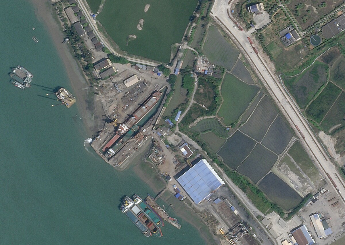
SkySat • Petrel 8 cargo ship, Fuan Matou Shipyard, Fujian, China • April 8, 2022 |
Earth’s oceans have harbored illicit activity for centuries. The massive, borderless realm has remained largely unregulated, but not for lack of trying. Revolutionary technologies are arming governments and security specialists with new tools to monitor and enforce maritime law. For illegal ships and the authorities holding them accountable, it’s high noon on the high seas. |
 |
 |
SkySat • Freeport, The Bahamas • February 3, 2021 |
|
|
|
|
|
|
|
|
|
|
|
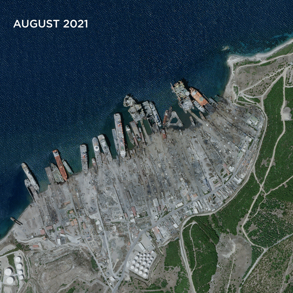
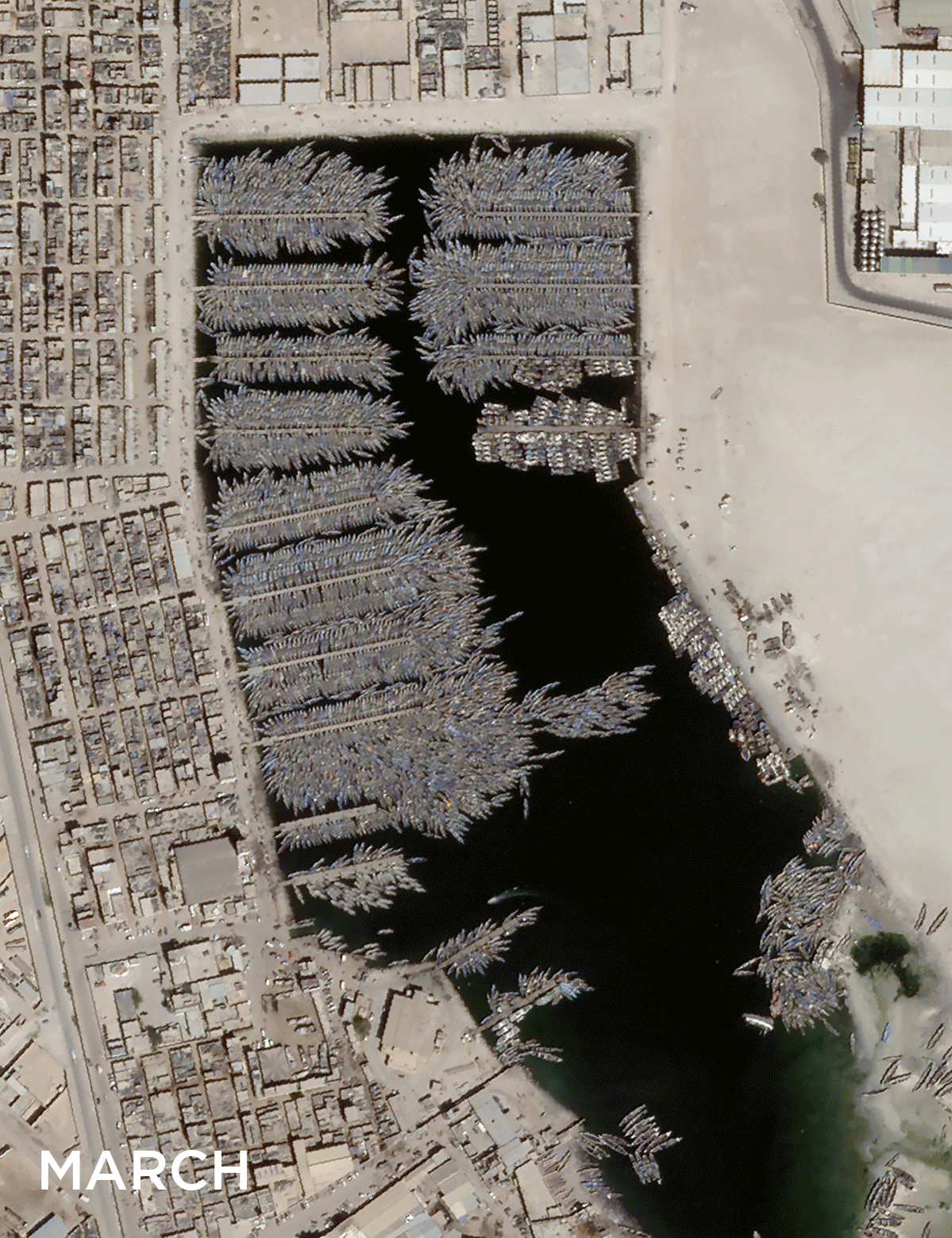
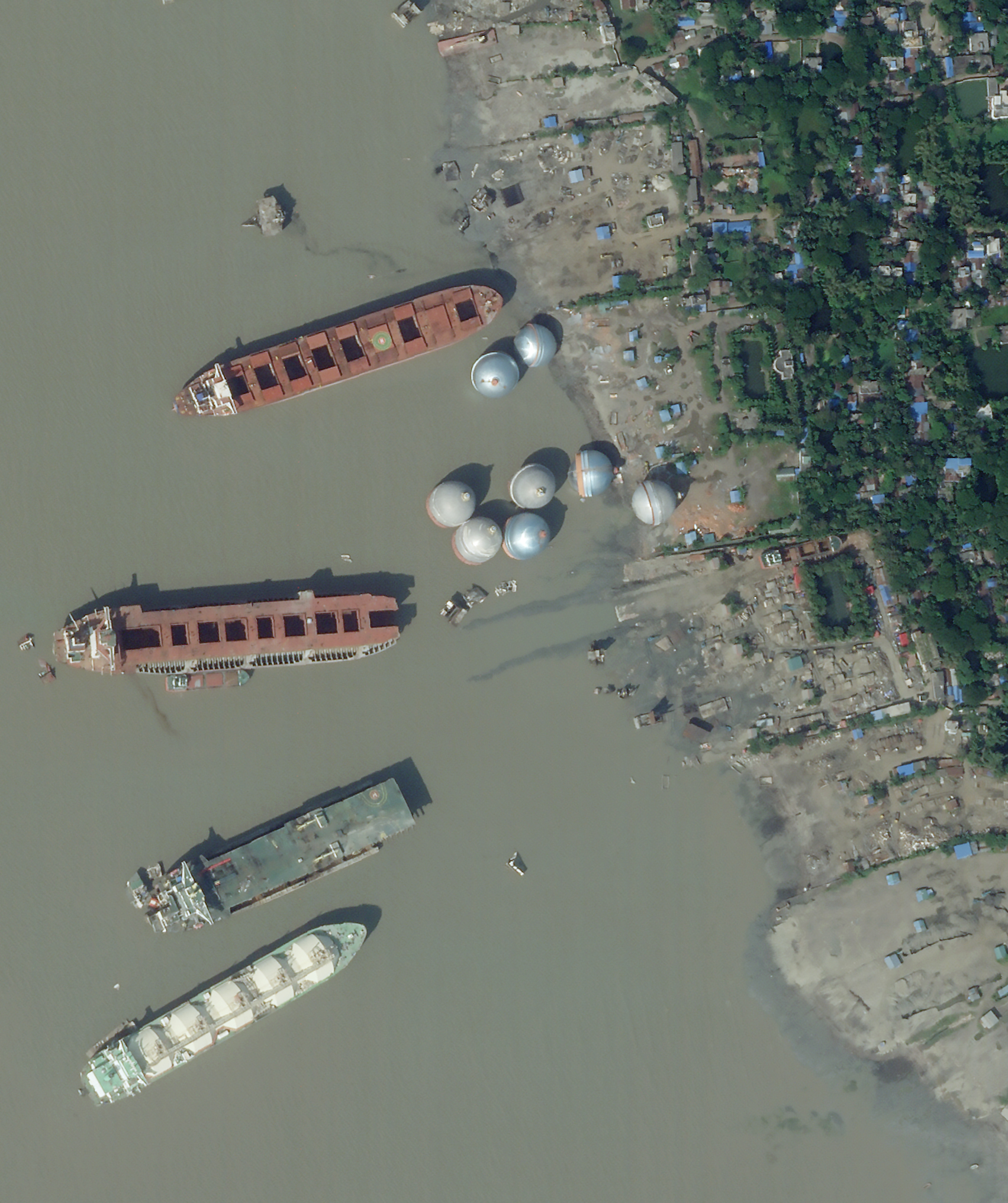
REMOTE SENSATIONSShip Graveyards
Seasick from all this boat talk? We hear you. Come take a breather on land and watch ships collect, be destroyed, and recycled at various ship graveyards around the world. And if anyone has any idea what those giant metal balls in the last image are, let us know cause we’re as lost as Atlantis. |
 |
 |
SkySat • Aliaga Ship Recycling Facility, Turkey • January 2021 - June 2023 |
 |
 |
SkySat • Small, decommissioned boats piling up in Nouadhibou, Mauritania • March 5 - May 16, 2023 |
 |
 |
SkySat • Chittagong Ship Breaking Yard, Chittagong, Bangladesh • October 29, 2022 |
|
|
|
|
|
IN THE NEWSHeat
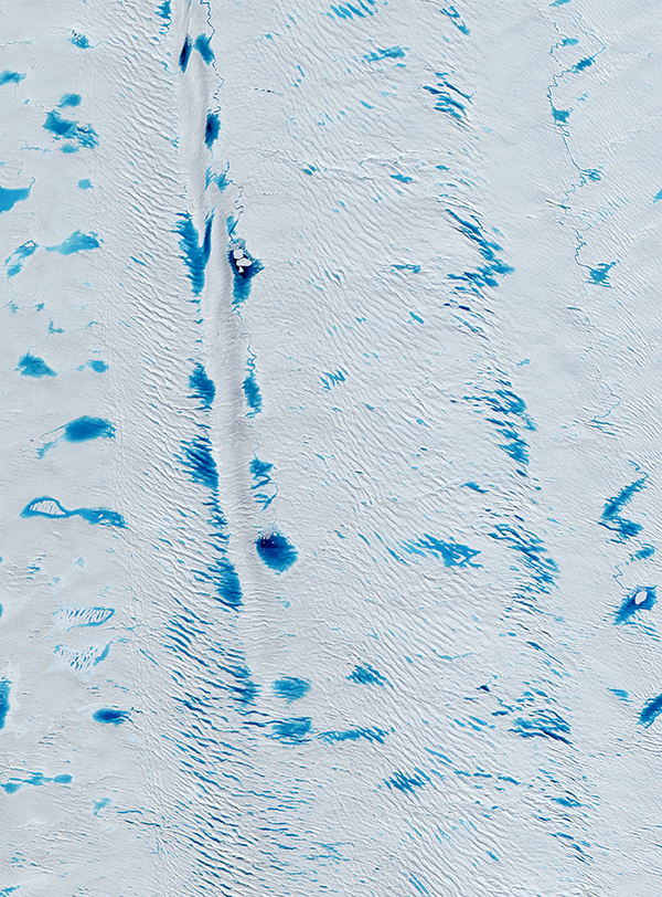
Climate change is promoting weather from the rank of small talk to big. This past week, the planet set records for the hottest day in modern history, floods inundated the Northeast US, Spain, and Japan, and fires continued to burn through Canada. Unfortunately, that list probably doesn’t even cover half of it. We’ll be reporting on these events, both here and on our socials, over the summer. But for now, chill out with us by looking at some melt pools atop Greenland’s Petermann Glacier. |
 |
 |
SkySat • Petermann Glacier, Greenland • July 9, 2023 |
|
|
|
|
|
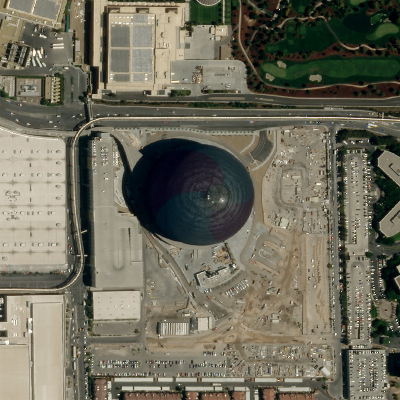
Weekly Revisit (plus The Sphere)
Last week we rounded up some of the world’s largest constructions… and already a record we included was broken. Las Vegas, known for making a splash, unveiled its newest building, The Sphere. The $2 billion dollar, LED-bedazzled, massive globe usurped the title of “world’s largest spherical building” from Avicii Stadium, but don’t let that take away from your enjoyment of the issue. |
 |
 |
SkySat / Edited by Overview • Palo Verde, Caracas, Venezuela • March 28, 2023 |
|
|
|
|