|
|
|
|
|
|
|
|
|
|
 |
|
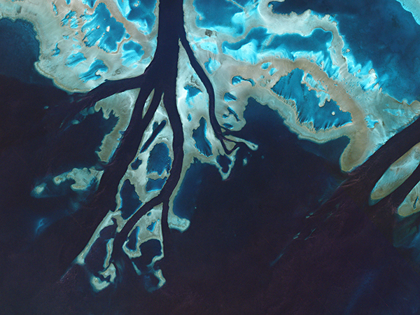
PlanetScope • Keep River Inlet, Australia • March 15, 2015
|
|
In this week’s issue: Satellites spot and map coral reefs around the world’s tropics, a dust storm gathers in South Africa, and a lithium mine is seen in Chile.
|
|
|
|
|
FEATURED STORY
Coral Reefs
|
|
Maybe you’re an avid diver or maybe you’ve just watched Finding Nemo, but chances are you’re a fan of coral reefs.
They’re the ocean’s living megastructure biodiversity hotspots—formed when coral colonies group and grow together to build massive underwater cities from
their limestone exoskeletons over millennia.
These ecosystems support 25% of marine life despite covering less than 1% of Earth’s surface.
|
 |
|
PlanetScope • Kure Atoll, Hawaii, USA • May 12, 2016
|
|
Corals exist all over the ocean, from its dark depths to its luminous surface.
But the reef-building variety are found in warm tropical waters where their symbiotic algae thrive.
Since the algae need light to photosynthesize, reefs form in shallow waters where light is most abundant.
And fortunately for us that means they’re visible to satellites as well.
|
 |
|
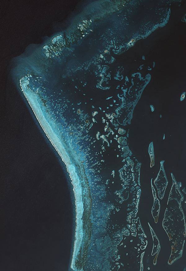
Image from Allen Coral Atlas mosaic
|
|
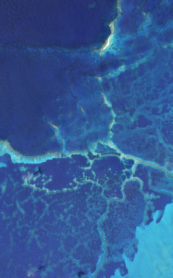
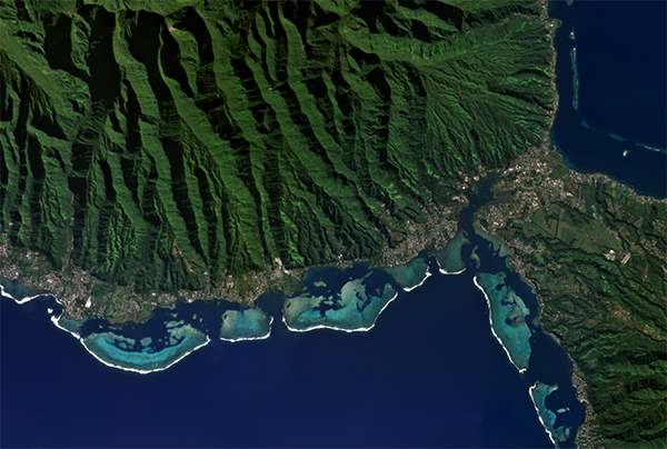
From space, coral reefs emerge in a brilliant spectrum of light blue from the surrounding darker shades of deeper ocean.
Earth-imaging satellites are able to observe these reefs because of their shallow depths and presence of sunlight.
Not shown, however, are the thousands of marine species that depend upon these
living mega-structures.
|
 |
|
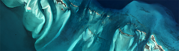
PlanetScope • Belize • April 14, 2019
|
|
Coral reefs are like the rainforests of the ocean: biodiverse, magnificent, fundamental for global ecosystems, and overall rather wet.
But both are also increasingly under threat by humanactivity.
As our climate warms, so do our oceans.
And warming ocean temperatures have killed off around 14% of coral reefs globally between 2008 and 2019.
|
 |
|
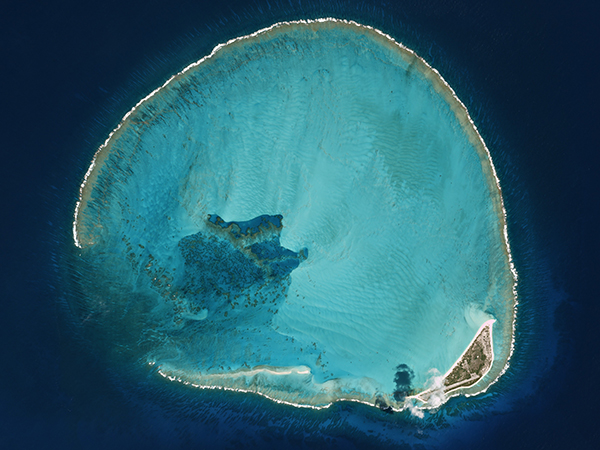
PlanetScope • French Frigate Shoals, Hawaii, USA • March 26, 2022
|
|
When conditions get too hot, corals become stressed and expel the algae from their tissue.
It’s called coral bleaching since it turns the corals white.
And it’s happening a lot more frequently now
than it was just decades ago.
Warming temperatures also cause ocean acidification, which reduces the calcium minerals available for corals to use.
Humans are placing increasing stress on these ecosystems, from global warming to damaging fishing practices to direct pollution.
|
 |
|
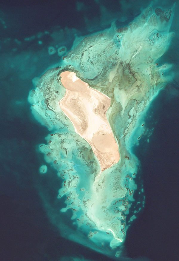
SkySat • Pointe d’Esny, Mauritius • August 11 - 17, 2020
|
|
Capitalism adores placing price tags on environmental “assets,” so the global value of coral reefs was calculated to be somewhere between $30 - $172 billion each year.
So, a lot.
Yet many would argue that these ecosystems are priceless (we agree).
Fortunately, a global movement is hard at work helping save corals.
And satellites are arming them with a new powerful tool.
|
 |
|
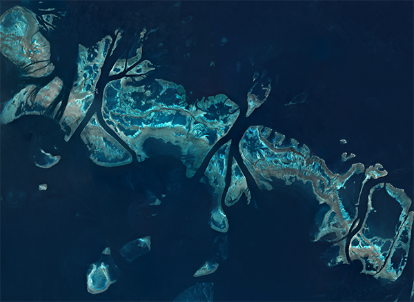
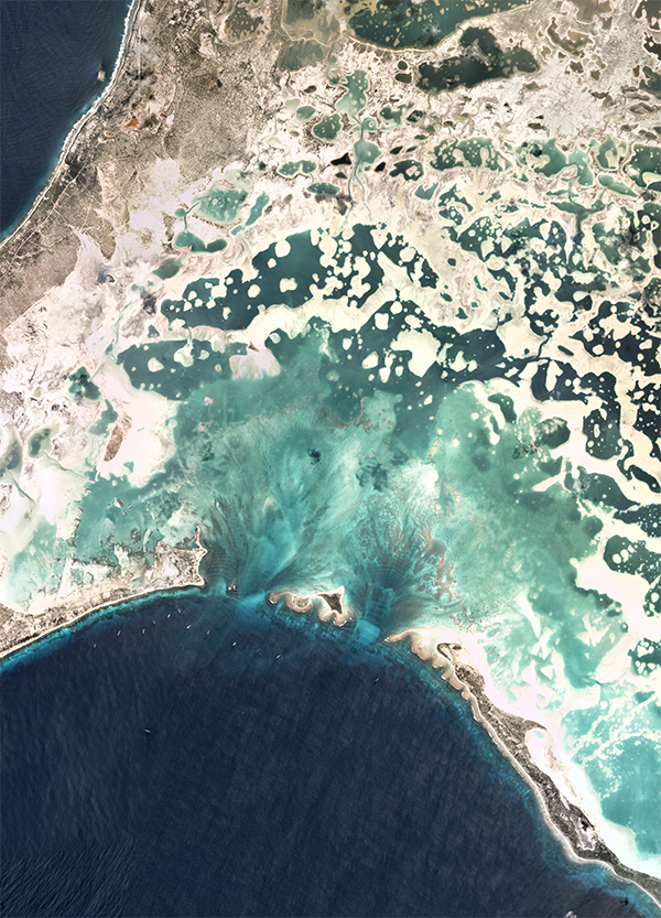
PlanetScope • Eritrea • May 1, 2019
|
|
|
It’s been almost 200 years since Charles Darwin created maps of coral reefs he discovered on his voyages.
While he did a pretty good job, all things considered, we’ve got far more tools available to us today.
And as you may have guessed, satellites are a crucial technology here.
Researchers announced the completion of the first comprehensive map of global coral reefs towards the end of last
year, named the Allen Coral Atlas.
|
 |
|
Image from Allen Coral Atlas mosaic
|
|
It’s a comprehensive atlas with over two million satellite images put together to map out the entirety of the world’s coral reefs.
And it even comes with a coral bleaching monitor.
Satellites have been surveying the ocean for a while, gathering data on sea surface temperatures, sea level change, and weather.
But this map is the first of its kind and a game changer for researchers around the world.
|
 |
|
Image from Allen Coral Atlas mosaic
|
|
Bonus: Everything in Australia appears to be extra large, so it only makes sense that the world’s largest coral reef is there too.
Unlike the country’s other animals though, these corals aren’t trying to kill you.
The Great Barrier Reef is gigantic.
It’s about the size of Germany or half the size of Texas.
And it contains around 3,000 individual coral reefs.
It’s also absolutely stunning, whether you’re diving in it or admiring its hues from space.
|
 |
|
PlanetScope • Great Barrier Reef, Australia • July 8, 2016
|
|
|
|
Dust Storm
|
|
We’re not quite over our Dune fever, so here’s a dust storm we captured a few years back in South Africa.
Strong winds are seen carrying dust from the higher terrain into the valleys below.
And speaking of which, last month a series of storms brought dust from
the Sahara Desert all the way over to Europe, turning the skies a Hollywood-apocalyptic orange and blanketing many regions in
a layer of reddish-brown dirt.
Though most of our satellite images are taken of static objects, we often capture events in motion.
Whether it’s smoke, floods, or dust storms, comparing these occurrences with previous, stiller imagery shows just how much can change on Earth’s surface in a given day.
|
 |
|
PlanetScope • Northern Cape, South Africa • July 5 - 16, 2020
|
|
|
|
|
|
Instagram Highlight: Daily Overview
|
|
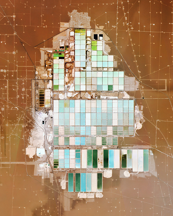
It’s only fitting that lithium—a critical element for certain batteries—is collected within what looks like a giant circuit board.
@dailyoverview created this image of Chile’s Salar de Atacama using Planet data.
It’s the third largest salt flat in the world and has the largest reserve of lithium of any location, with over 25% of the planet’s supply.
|
 |
|
Created by Overview • Source imagery from Planet
|
|
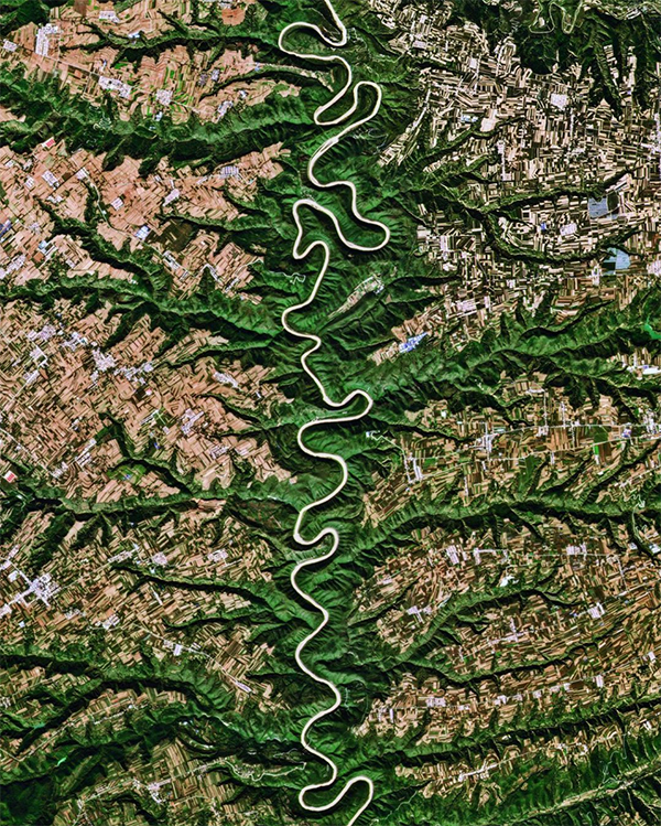
We’re doing a double feature this week since Overview also posted this stunning image of the Jing River in China.
Valleys, farmland, and towns surround this winding artery for 455 km (283 mi).
Also we love spotting natural fractal patterns—as we covered last week—and this one is too good to pass up.
|
 |
|
Created by Overview • Source imagery from Planet
|
|
|
|
|
|
|
|