|
 |
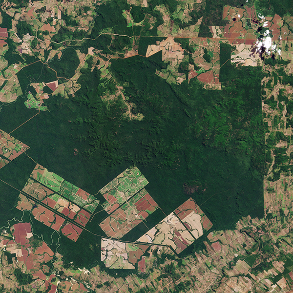
| SkySat • Mato Grosso, Brazil • May 28, 2018 |
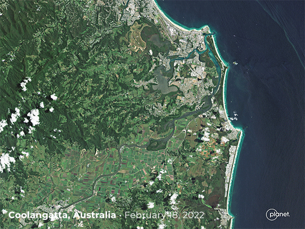
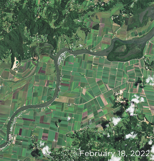
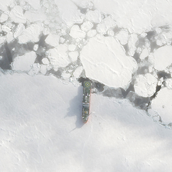
| In this week's issue: Satellites monitor global deforestation, imagery shows recent developments in Russia's invasion of Ukraine, torrential rains flood parts of Australia, herrings gather to spawn on the coast of Canada's Hornby Island, and Endurance22 discovers a shipwreck. |
|
|
|
|
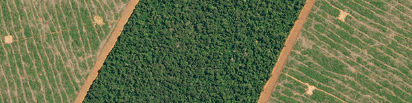
FEATURED STORY Forests Part 1: The Deforestation Problem |
| The UN General Assembly's International Day of Forests is less than two weeks away (March 21), so we're dedicating the next two issues to the problem of deforestation (Part 1) and how satellite data is helping global initiatives fight back (Part 2).
Whether it's purifying our air or keeping our prehistoric ancestors safe from predators, forests are vital for human life. Well, all life on Earth. Forests have a branch in just about every natural process there is. They cover 31% of all land area, and like the oceans, they're indispensable for protecting biodiversity and regulating Earth's climate. But when cut down, they also provide commercial resources and land for agriculture, mining, and settlement. Yet, as is the case with so many activities we know will harm us in the long run, we continue them anyway.
|
 |
| SuperDove Composite • Matupá, Mato Grosso, Brazil • June 13, 2021 |
| Deforestation is not a new hazard—there's a reason the term "tree-hugger" is one of the oldest labels for environmentalists. Tree loss threatens forests' ability to protect the health of dependent communities and function as a global barrier against climate change. Earth's forests have decreased by roughly 420 million hectares (1 billion acres) in the past 30 years. And the loss in tropical regions is even more concerning. In 2020 alone, the tropics lost over 12 million hectares (30 million acres) of tree cover, equating to around 30 soccer fields of trees every minute. Whichever way you choose to measure it, the rate is alarmingly fast.
|
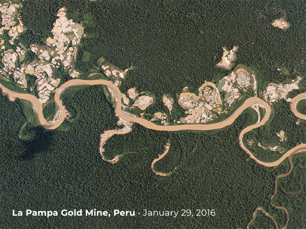 |
| PlanetScope • La Pampa Gold Mine, Peru • January 2016 - January 2017 |
| For those that are more financially oriented, the value of ecosystem services provided by forests are estimated to be $150 trillion. While putting a price tag on something indispensable to life may seem pointless, consider that most of deforestation's primary drivers are commercial: agriculture, commodity production, and logging. The Southeast Asian island of Borneo has lost half of its forest cover from logging, fires, and development of palm oil plantations.
|
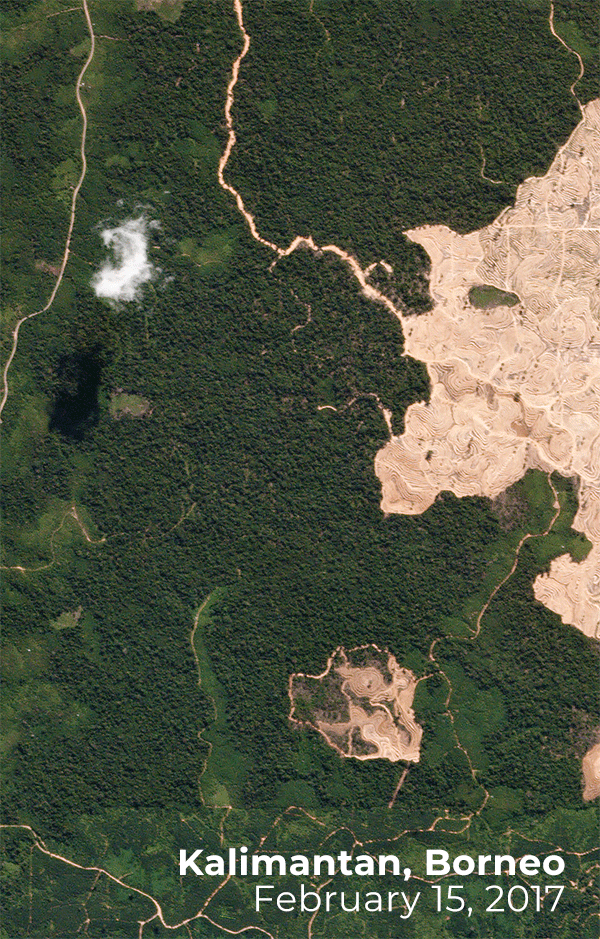 |
| PlanetScope • Kalimantan, Borneo, Indonesia • February 15 - July 9, 2017 |
| In terms of size, the Amazon rainforest tops the charts: it's home to 40,000 plant species and 390 billion individual trees, to name a couple. But it's also on the cusp of irreversible decline. The Amazon has lost 17% of its forested area to agriculture in the past 40 years. And a recent study used satellite data to conclude that over 75% of the rainforest is in danger of losing its resilience to regenerate after stress.
The visual perspective: deforestation in the Amazon often occurs in a "fishbone pattern," where sections of forest are cleared along the sides of roads.
|
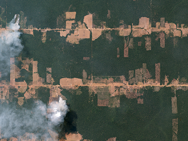 |
| PlanetScope • Rondônia, Brazil • August 5, 2016 |
| Over time, satellite imagery reveals gradual changes to forest cover. In each successive shot forested areas are removed, as if watching a timelapse of a sculptor carve a slab of marble piece by piece. But its cumulative effects can be sudden and disastrous. Climate change is accelerated by feedback loops, and each tree removed is another lost carbon sink that helps buffer against the effects of global warming.
|
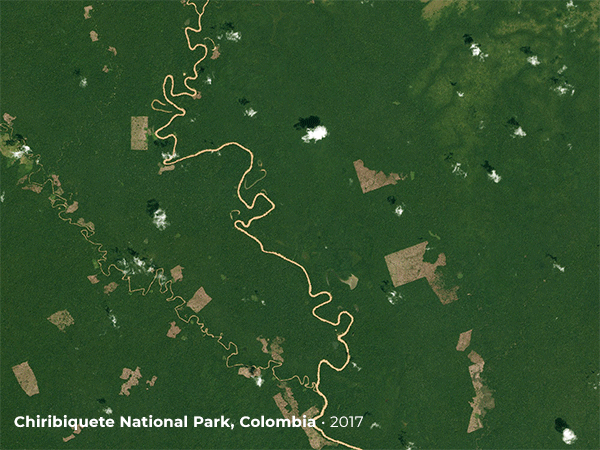 |
| PlanetScope • Chiribiquete National Park, Colombia • 2017 - 2021 |
| Deforestation is a multifaceted problem and its causes are wide-ranging. The semi-good news is that there's a global effort to bring forests back. And while the total area of forests is still decreasing, data suggests that the rate of its loss is diminishing. As new tools for monitoring global change emerge and grow, it becomes easier for countries, organizations, and initiatives to act on deforestation and support efforts to regenerate these environments.
|
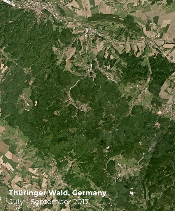 |
| Quarterly Basemap • Thüringer Wald, Germany • July - September 2017 - 2020 |
|
| Tune back in next week for Part 2 on how satellite imagery is creating a powerful global dataset for reforestation solutions and what the path forward looks like. |
|
|
|
Ukraine Update |
| Russia's full-scale invasion of Ukraine enters its third week as forces advance toward major cities and international sanctions tighten in response. We continue to provide imagery to our partners in governments, aid and relief organizations, data analysts, and media. Cloud cover has concealed many of the on-the-ground developments from satellite view, but here are some recent images we've captured of the conflict.
A Dove satellite captured a plume of smoke directly following a Russian rocket launch out of Belgorod Oblast, Russia on February 27th.
|
 |
| PlanetScope • Belgorod Oblast, Russia • February 27, 2022 |
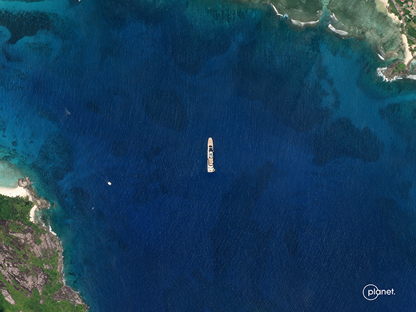
| Governments are focusing on seizing foreign assets of Russian oligarchs in the wake of the invasion of Ukraine. This SkySat image shows what appears to match the design of the superyacht, Nord, near the Seychelles. |
 |
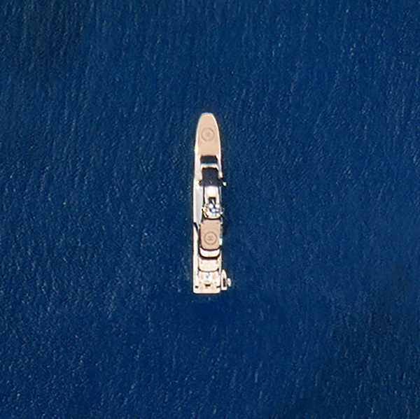 |
| SkySat • Seychelles, Indian Ocean • March 7, 2022 |
| A large number of helicopters sit alongside a handful of fixed-wing aircraft on the flight line of Machulishchy Air Base, on the outskirts of Minsk, Belarus.
|
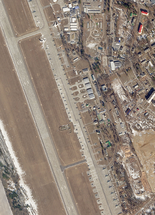 |
| SkySat • Minsk Region, Belarus • March 8, 2022 |
|
|
|
|
|
|
|
Twitter Highlight: Herring Spawn |
 |
| PlanetScope (via Lianna Gendall) • Hornby Island, British Columbia, Canada • March 6, 2022 |
| There's been a lot of tragic loss in the world recently. So we wanted to close out this issue with an act of creation—one that can be seen from space. This herring spawn along the coast of Hornby Island in British Columbia, Canada was spotted in Planet data by marine ecologist and University of Victoria student Lianna Gendall. Each spring, tens of thousands of herrings gather near coastlines to reproduce, turning the waters a cloudy white with their milt and eggs. Herrings are a cornerstone of the region's marine food chain, so the annual event attracts a number of predators (as well as curious scientists and satellite image enthusiasts)!
|
|
|
|
|
|
|
|
|
|