 |
 |
|
SkySat • Yelnya, Russia • November 29, 2021
|
|
In this week's issue: Satellite images show Russian troop buildup and movement around Ukraine's border, a giant marine sinkhole is spotted off the coast of Belize, and a SkySat captures an
early morning snap of Ottawa.
|
|
|
|
|
FEATURED STORY
Russia-Ukraine Conflict
|
|
On Monday, both the US and the EU declared that they would impose sanctions following Putin's order of troop deployment to two Russian-backed separatist regions in Ukraine.
This is the latest development in a conflict that's been building as Russia amasses over 150,000 troops along the Ukrainian border.
The situation as a whole has been marred by incomplete data, false-flag operations, and general confusion.
State leaders say one thing, their actions another.
But open-source intelligence is changing the geopolitical arena.
From satellite imagery to TikTok videos, accessible data gives everyone from government officials to citizens an eye on the ground.
And credible intel is vital in a conflict centered around narrative and disinformation.
Social media reports are cross-referenced with satellite imagery to map out troop movements and verify official claims.
And for the past few months satellite imagery providers have helped journalists and experts monitor key locations.
Here's what they've discovered along the Ukrainian border using Planet data.
|
 |
|
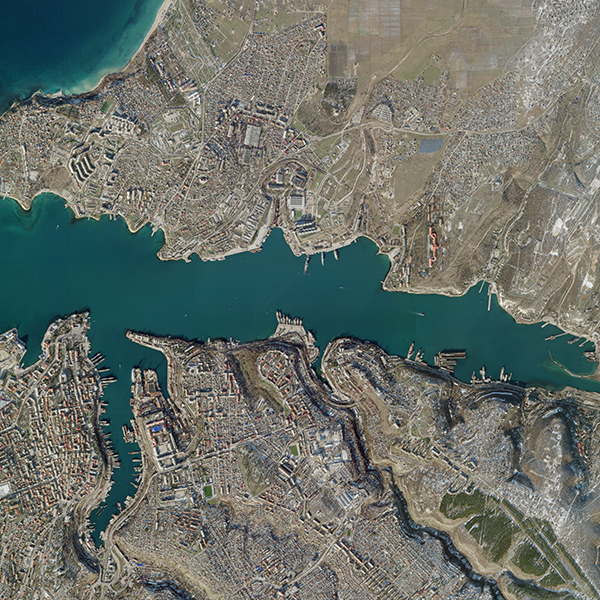
SkySat • Sevastopol Naval Base, Crimean Peninsula • January 27, 2022
|
|
On February 14th, Putin claimed that Russia was withdrawing some troops after completing military drills.
But evidence suggested otherwise.
Satellite imagery showed sustained buildup and movement towards Ukraine's border, contradicting the Kremlin's narrative.
In cases of asymmetric information like this, open-source data can help keep world leaders accountable.
|
 |
|
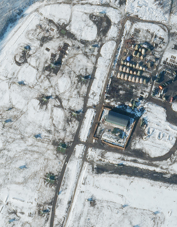
SkySat • Helicopters in Valuyki, Russia • February 20, 2022
|
|
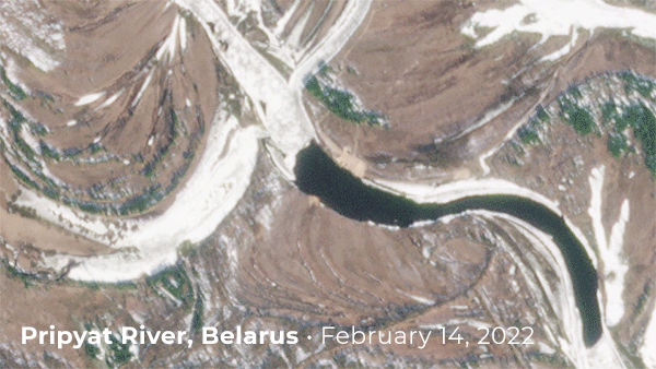
On February 17th, CNN reported on the construction of a pontoon bridge across the Pripyat River in southern Belarus, just 4 miles (6 km) from the Ukrainian border.
The bridge would significantly expedite the time needed to cross into the country.
Satellite imagery showed the construction of the bridge between February 14 and 15th, just a day after Putin declared Russia's withdrawal.
Listen here to CNN's The Situation Room discussing the bridge and other movements along the border.
|
 |
|
PlanetScope • Pripyat River, Belarus • February 14 - 15, 2022
|
|
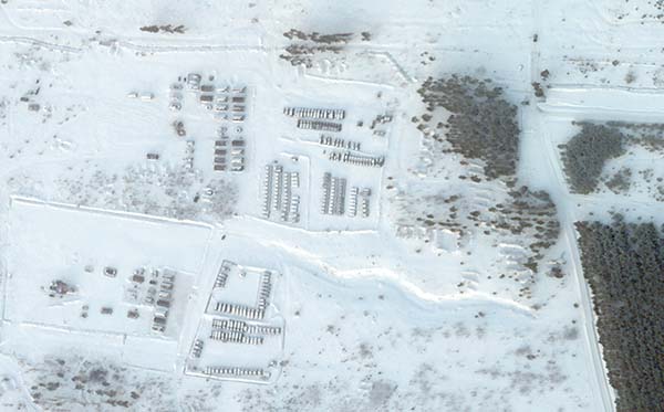
The Wall Street Journal analyzed satellite imagery and verified TikTok videos that suggest Russian forces and equipment have moved from larger garrisons to smaller units along Ukraine's northern border.
Some experts consider this dispersion the final stage before an invasion.
One Planet image of a training area in Kursk has grown in recent
weeks and upturned dirt implies heavy activity at the site.
|
 |
|
SkySat • Kursk, Russia • February 13, 2022
|
|
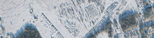
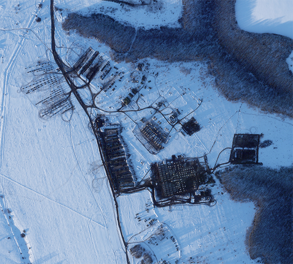
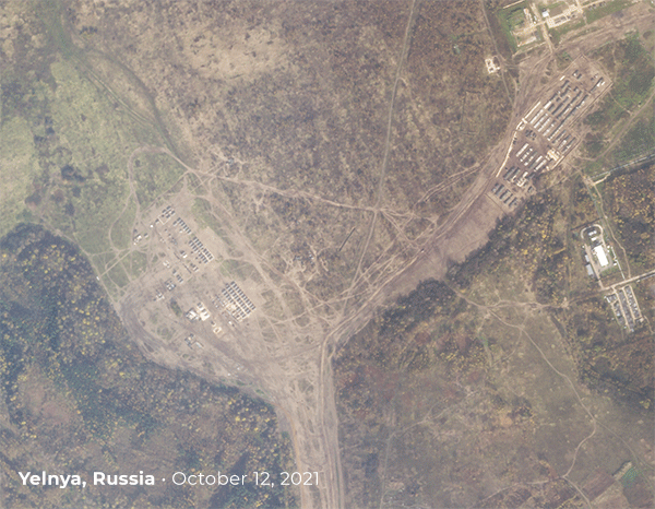
Reporters at The Economist used Planet imagery to show buildup at a base in Yelnya, Russia in an article titled "A new era of transparent warfare beckons," published on February 19, 2022.
The photos show what appears to be rows of howitzer artillery and infantry-fighting vehicles between October and the end of December in 2021.
|
 |
|
SkySat • Yelnya, Russia • October 12 - December 29, 2021
|
|
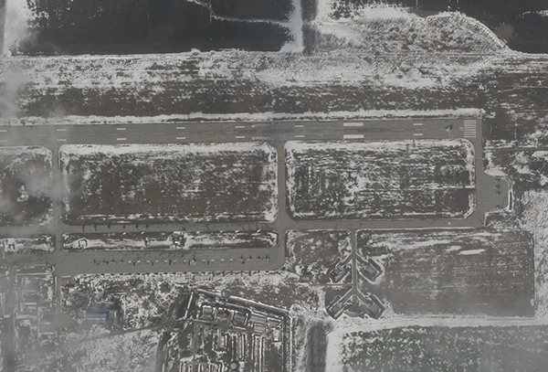
In an investigative video, The New York Times compared satellite imagery with social media posts to track Russian movement around the Ukrainian border.
Multiple aircrafts can be seen in this February 11th image of an airfield in Luninets, Belarus, approximately 200 miles (322 km) from the Ukrainian capital of Kyiv.
Chris Biggers, Mission Applications Director at HawkEye 360, notes that the number of Frogfoot aircraft shown in the image increased from 15 on February 4th to 32 on February 11th.
|
 |
|
SkySat • Luninets, Belarus • February 11, 2022
|
|
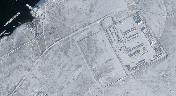
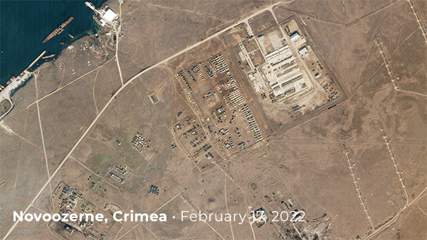
Sky News created an interactive map with satellite images to show troop buildup in parts of Russian controlled Crimea.
Analysts say that tents constructed in Novoozerne, Crimea near Ukraine's southern border can hold over 1,000
troops.
|
 |
|
SkySat • Novoozerne, Crimea • December 23, 2021
|
|
Planet has taken images over the past few months that show the camp's expansion.
Chris Biggers compares Planet's February 19th image of Novoozerne with a social media video showing on-the-ground convoy formations in the same area.
|
 |
|
SkySat • Novoozerne, Crimea • February 17 - 19, 2022
|
|
On January 28th, the Associated Press reported on intelligence findings concerning Russia's troop development.
An image of the Pogonovo training area near the Russian city of Voronezh was used to show stationed vehicles and tanks.
|
 |
|
Pogonovo training area, Russia • January 26, 2022
|
|
Reporters and analysts have been sharing information and satellite imagery of the unfolding situation on Twitter as well.
Christoph Koettl, a Visual Investigations journalist at the New York Times has been monitoring events as seen by satellite imagery.
Chris Biggers at HawkEye 360 has compiled and analyzed multiple sources of satellite data of various locations, including this Planet image of aircraft at Millerovo,
Russia.
|
 |
|
SkySat • Millerovo, Russia • February 11, 2022
|
|
Satellite imagery will continue to play a critical role as the conflict unfolds.
From tracking troop movements to substantiating claims, open-source intelligence has changed the nature of international disputes.
Stay up-to-date with satellite imagery of the conflict by following us on Twitter.
And if you're a reporter or analyst seeking accessible information, reach out by email to be included on our press mailing list.
|
|
|
|
Great Blue Hole
|
 |
|
SkySat • Great Blue Hole, Belize • July 21, 2020
|
|
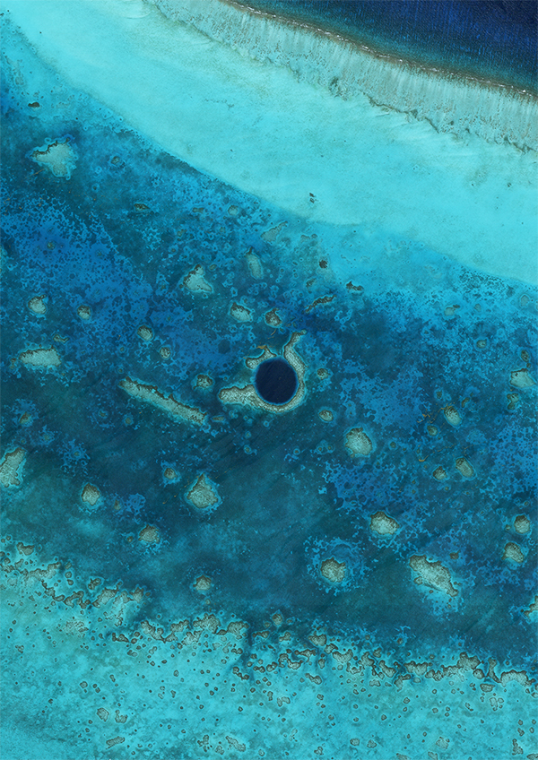
How's jumping from an impending war to a giant hole in the ocean for a non sequitur? The Great Blue Hole, as its self-describing name suggests, is a giant sinkhole found in a reef off the coast of Belize.
With a signature deep blue color and measuring 1043 feet (318 meters) wide and 407 feet (124 meters) deep, it's
easily spotted from space.
Adding to the sinkhole's curiosities are stalactites found around 394 feet (120 meters) down.
The mineral formations are created by dripping water, meaning at one point in its history the Great Blue Hole was more likely a Dry Brown Cave.
|
|
|
|
Snow, Shadows, and a Protest
|
 |
|
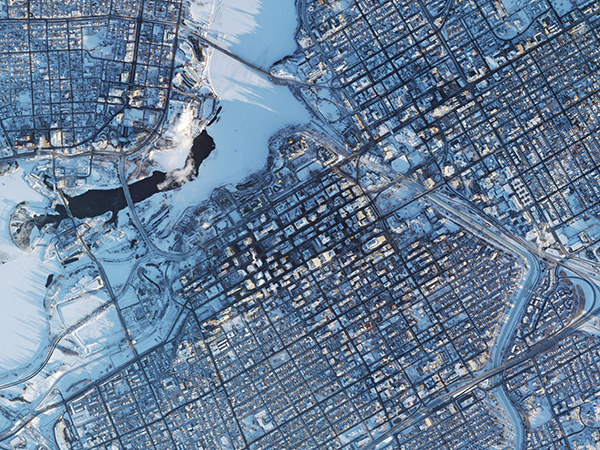
Caption: SkySat • Ottawa, Canada • February 13, 2022
|
|
Long shadows cast by Ottawa's skyscrapers reach across the river in this early morning shot of Canada's capital.
For weeks, Ottawa's Parliament building has been a focus point for a protest over COVID-19 mandates.
Trucks have blocked major roads within the city and elsewhere, disrupting traffic and trade routes between the US and Canada.
|
|
|
|
|
|
|
|
|
|