 |
 |
|
SkySat • Zhangjiakou, China • January 26, 2022
|
|
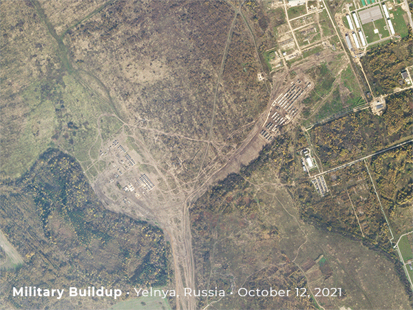
In this week’s issue: Satellites spot venues for 2022’s Winter Games in Beijing, researchers find thunderstorm damage from a heat dome in Canada, satellite data helps a team study a volcano
in the Peruvian Andes, and Russia continues to amass troops on the Ukrainian border.
|
|
|
|
|
FEATURED STORY
Winter Games
|
|
The Winter Games of 2022 kicked off last week in Beijing to muted applause and masked cheers amidst Covid concerns—though the athletic feats themselves have proven exciting so far.
Tight Covid restrictions have certainly changed the appearance of things at the Games on the ground.
But the stadiums, slopes, and courses look how you might expect from space.
Doves have long been used at the games’ opening ceremonies, so it’s only fitting for us to use our flock of Doves and SkySats to watch from afar.
|
 |
|
SkySat • Zhangjiakou, China • January 29, 2022
|
|
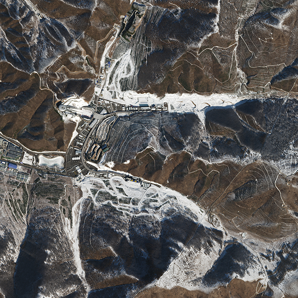
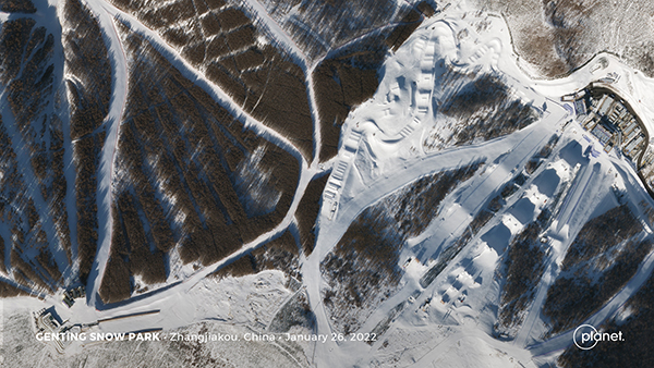
While skiing has been around since at least 6000 BC, snowboarding has more recent origins.
The sport was invented in 1965 when a Michigan man tied two skis together to create a sled for his kids.
His wife named the new device a “snurfer” since it emulated surfing over snow.
Now skiing and snowboarding are two of the most popular sports played at the Winter Games.
Athletes will perform tricks by a snow replica of China’s Great Wall in the Genting Snow Park.
|
 |
|
SkySat • Zhangjiakou, China • January 26, 2022
|
|
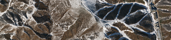
The snowboarding and skiing Big Air events are taking place in a former steel mill.
Athletes drop down the 64-meter (210-foot) ramp and are launched into the air against a steampunk
backdrop of the converted industrial area.
Take a top-down look at the cooling towers placed right behind the Big Air ramp.
|
 |
|
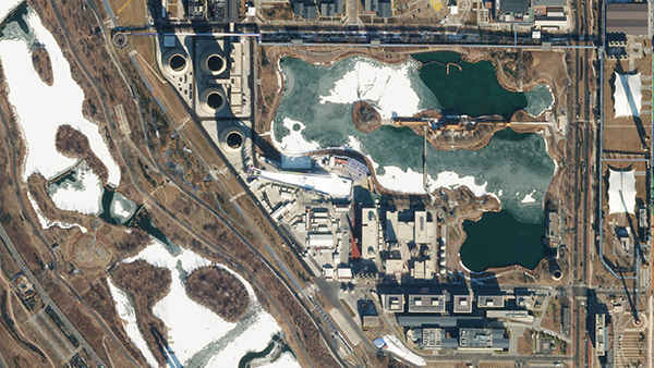
SkySat • Shougang, China • January 29, 2022
|
|
Beijing is the first city in history to host both a Summer and Winter Games.
The region’s dry climate, however, isn’t great for creating natural snow.
That means every
flake used for the 66 medal events that require snow will be artificially produced.
|
 |
|
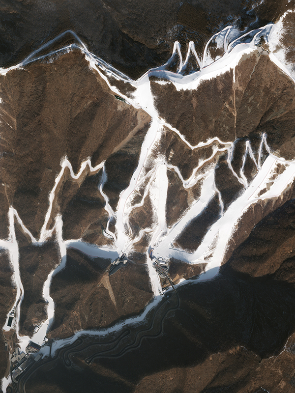
Yanqing District, China • January 9, 2022
|
|
Organizers of this year’s Games designed the event with a closed loop strategy in order to restrict the spread of Covid.
Also looplike is the Yanqing National Sliding Center built to host the bobsleigh, luge, and skeleton sporting events.
The structure is shaped like a coiled snow dragon guarding the base of Yanqing Distrct’s mountains.
|
 |
|
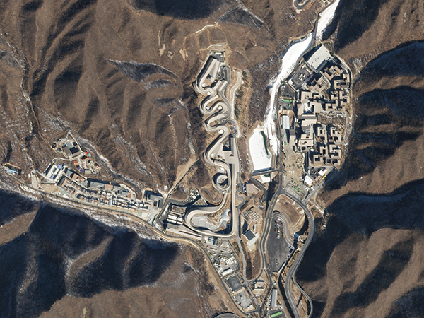
SkySat • Yanqing District, China • February 4, 2022
|
|
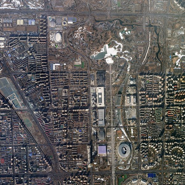
Skating sports are taking place in downtown Beijing.
Two stadiums—the newly-built National Speed Skating Oval and the Beijing National Stadium—can be seen in this overview of the city.
|
 |
|
SkySat • Beijing, China • January 28, 2022
|
|
|
Did you know our SkySats also take video? We actually caught a skier flying through a downhill course on a practice run.
Break out your magnifying glass and detective skills to see if you can find him.
|
|
|
|
Downburst Damage
|
 |
|
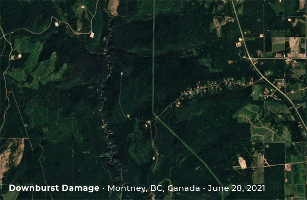
Planetscope, unprocessed Explorer data • Montney, BC, Canada • June - July 2021
|
|
In 2018, the Northern Tornadoes Project (NTP) began using Planet imagery to identify tornado damage in Canada.
The NTP team has since discovered and documented hundreds of previously unknown and new tornado damage paths in both heavily forested areas and agricultural zones across the country.
However, the researchers frequently come across other thunderstorm-related damage as well, including that from downbursts (powerful bursts of wind from thunderstorms).
After reviewing Planet imagery along the tracks of thunderstorms that developed on the northern edge of a record-breaking heat dome in western Canada on June 30th, 2021, dozens of damaging downburst events were identified in northern British Columbia and Alberta.
Researchers estimated that the maximum winds within several of the downbursts reached 190 km/h (EF2 rating on the Enhanced Fujita scale), leaving behind thousands of downed trees and a scarred landscape.
Write-up was written and provided by Lesley Elliot, a Research Meteorologist with the Northern Tornadoes Project.
Want to share how you’re using Planet data for a chance to be featured? We’ve got a form for that!
|
|
|
|
Tongue of Fire
|
 |
|
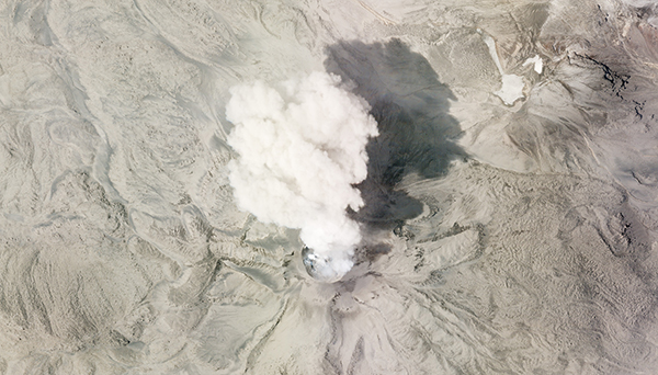
SkySat • Sabancaya Volcano, Peruvian Andes • July 8, 2020
|
|
The Sabancaya volcano—meaning “tongue of fire” in Quechuan—sits in the southern Peruvian Andes.
Records of eruptions there span back hundreds of years, making it a site of interest to volcanologists around the world.
A team of researchers has led a new study on how the conditions beneath the volcano have changed over time to result in the activity visible at the surface.
For active volcanoes like Sabancaya in particular, satellite data plays a critical role since collecting information can be especially difficult and dangerous.
Read more on our newest Science Wednesday blog and check out the full study in the Bulletin of Volcanology.
|
|
|
|
|
|
|
|
Instagram Highlight: Overview
|
 |
|
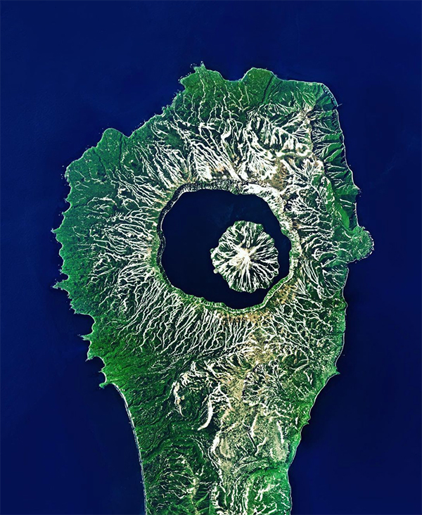
Created by Overview, source imagery from Planet
|
|
Repost from @dailyoverview : “The Tao-Rusyr Caldera is a stratovolcano located on Onekotan Island, in Russia’s Far East.
Roughly 7.5 kilometers (4.6 miles) wide, it contains the waters of Kol'tsevoe Lake and a large symmetrical cone, Krenitsyn Peak, which rises from the lake.
Onekotan is part of the Kuril Islands, a volcanic archipelago and segment of the “Ring of Fire” — a path of tectonic activity that circles the Pacific Ocean.”
|
|
|
|
|
|