Planet Snapshots
JANUARY 27, 2022
Issue #10
|
 |
|
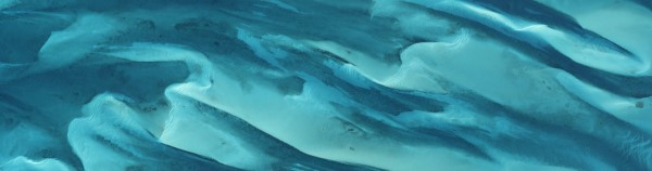
PlanetScope image of shallow seas off the coast of Griffin’s Cay in the Bahamas — 2016
|
|
In this week’s issue: A look around some of the most interesting sights we’ve captured over water, a river snakes through the world’s northernmost sand dune, and a fire burns near a
popular bridge.
|
|
|
|
|
FEATURED STORY
Aquatic Wonders
|
|
Seventy-one percent of Earth’s surface is covered in water, but satellite imagery tends to focus on terrestrial areas.
This week we wanted to show some love to lakes, rivers, seas, and the open oceans.
From swirling phytoplankton blooms to seaweed farms to bright blue reefs, take a look at some of the most extraordinary spectacles we’ve captured on the water.
|
 |
|
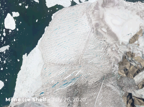
Captured by PlanetScope — July 26 - 31, 2020.
|
|
If the poles serve as Earth’s freezer, then calving glaciers act as its ice dispenser.
Icebergs are sent floating into the sea when they break off in events like this collapse of Canada’s Milne Ice Shelf.
|
 |
|
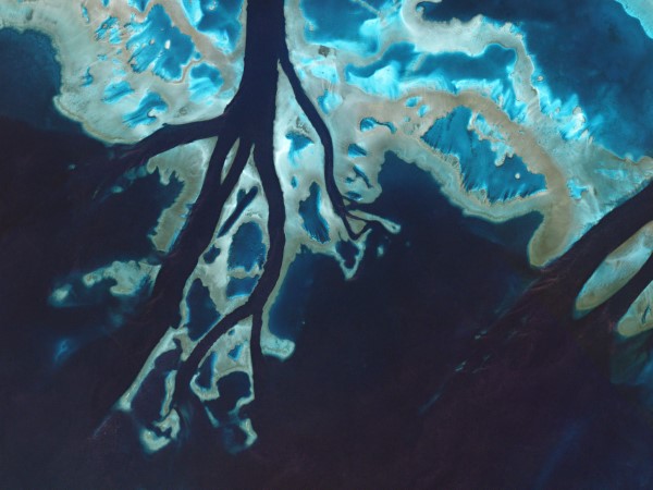
Captured by PlanetScope — July 8, 2016.
|
|
You can’t talk about the ocean without mentioning the Great Barrier Reef: a system of coral reefs over 1400 miles (2253 km) long off the coast of Australia.
This image shows a tidal channel cutting through one of its nearly 3,000 individual reefs.
|
 |
|
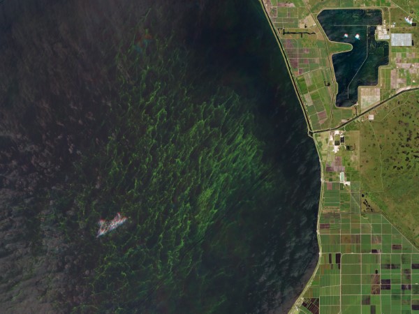
Captured by RapidEye — July 1, 2016.
|
|
Not everything that lives in the ocean, however, is welcomed by humans.
Back in 2016, a massive algal bloom in southern Florida prompted the governor to declare a state of emergency.
Pollution in Lake Okeechobee combined with high rainfall and warm temperatures to create this
putrid-smelling green monster.
|
 |
|
Captured by PlanetScope — June 10, 2021.
|
|
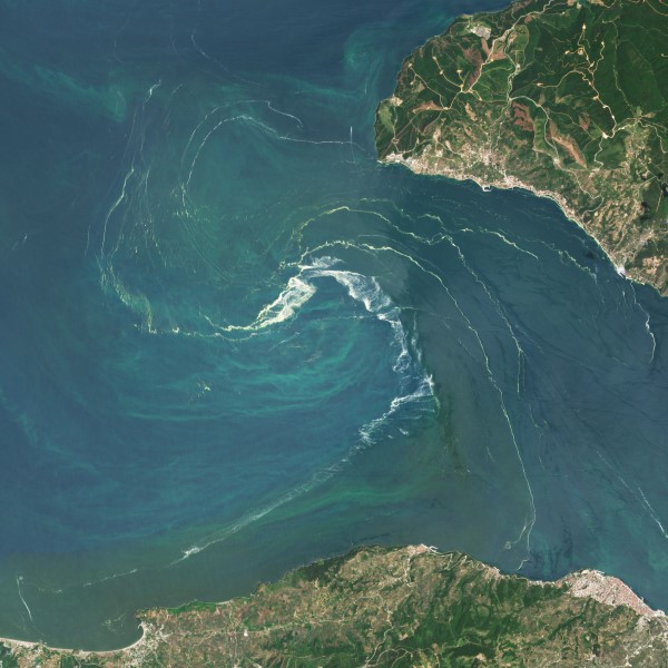
Last year, a massive phytoplankton bloom was spotted swirling in the Sea of Marmara near Istanbul, Turkey.
Add “giant eddy of sea snot” to the list of things we’d like to avoid encountering in the sea.
|
 |
|
Captured by PlanetScope — April, 2016.
|
|
The ocean’s surface usually appears frenzied and varied, so highly organized patterns may come as a surprise.
In Great Britain’s Thames Estuary, 175 offshore wind turbines are organized in a grid.
|
 |
|
Captured by PlanetScope — July 14, 2016.
|
|
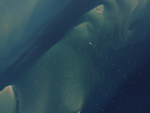
Seen here is the less sustainable but comparably energetic relative of the wind farm: the oil rig.
The Kashagan Oil Field is a network of 10 human-made islands built to extract oil and gas from one of the largest deposits found in recent history.
|
 |
|
Captured by PlanetScope, first spotted by Amazon Conservation— December 31, 2021 - January 18, 2021a.
|
|
|
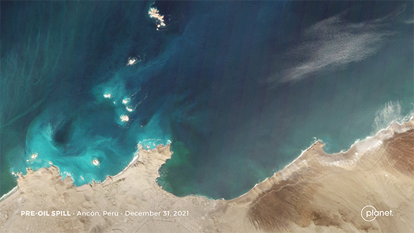
With oil production and transportation comes mistakes and spillage.
When spotted from satellite imagery, these spills stain blue waters with a sinister sheen.
Last week, tsunami waves from the Hunga Tonga eruption rocked a tanker unloading oil near Lima, Peru from 6,400 miles (10,000 km) away.
The thousands of barrels of oil spilled can be seen spreading along the coast in these before and after satellite images.
|
 |
|
Captured by PlanetScope — October 19, 2021.
|
|
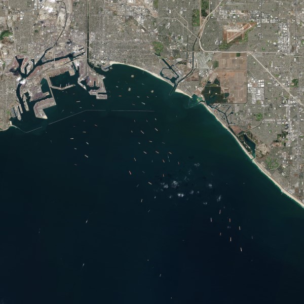
Our Doves often spot the tens of thousands of merchant ships sailing the seas every day, and sometimes we capture dozens of them in one image.
Last fall, a record number of ships waited to enter the ports of Los Angeles and Long Beach amid
major disruptions to the global supply chain.
|
 |
|
Captured by PlanetScope — March 2, 2015.
|
|
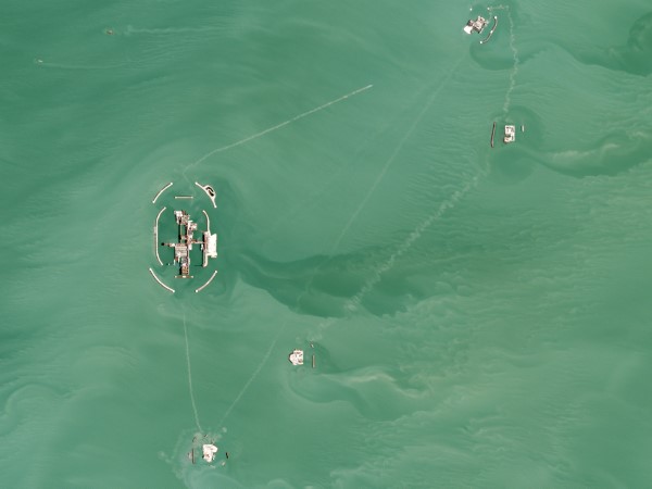
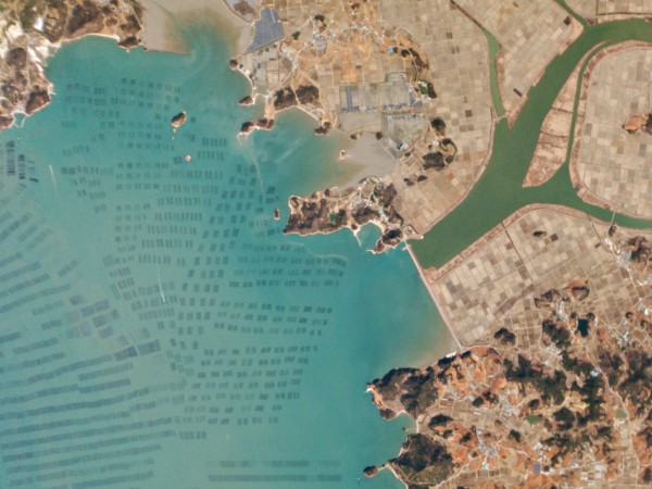
Patchwork farms: seaweed is grown in grids in South Korea’s Myeongnyang Strait, matching their terrestrial grain counterparts by the shore.
|
 |
|
Captured by PlanetScope — March 27, 2016.
|
|
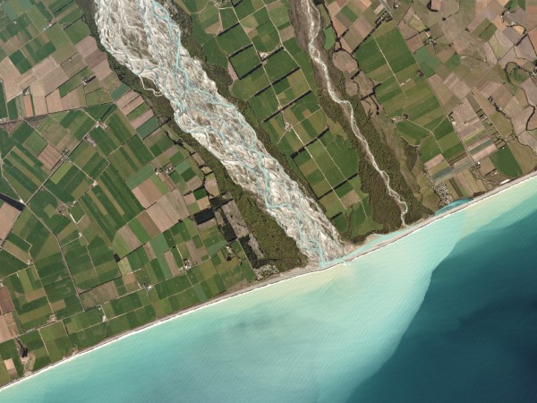
In New Zealand, the braided Rakaia Rivers transports glacial mountaintop water to the Pacific Ocean.
Right by the river’s mouth is a hapua, a lagoon that forms parallel to the shore.
|
 |
|
Captured by Planetscope — September 11, 2019.
|
|
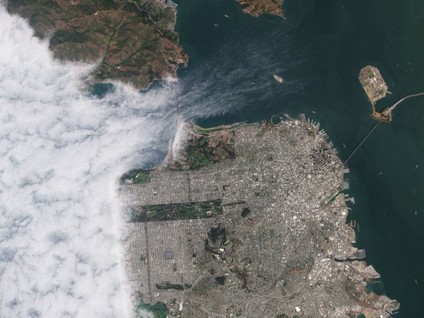
We’re fascinated by all of Earth’s lakes, rivers, seas, and oceans.
But we’re also partial to the waters that surround Planet’s headquarters in San Francisco… and to Karl the Fog’s frequent visits.
We’ve only scratched the surface of Planet’s aquatic archive.
Stay tuned for a future part 2!
|
|
|
|
What in the World
|
 |
|
Captured by PlanetScope — June 6, 2021.
|
|
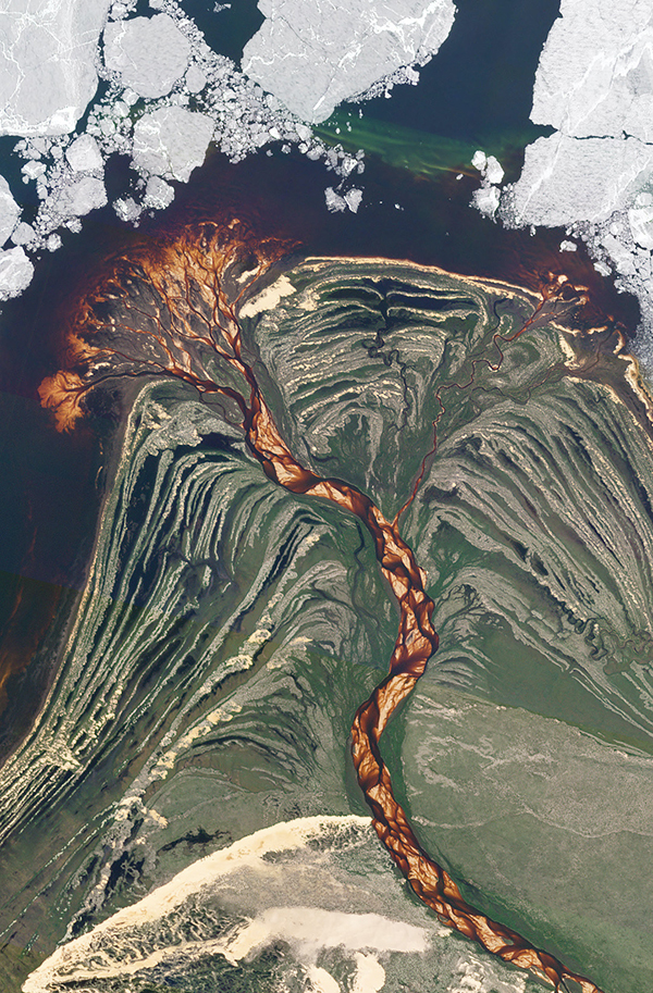
Every once in a while we come across an image that makes us question whether what we’re seeing was shot on Earth.
We spotted this image of sand dunes meeting a partially frozen lake in northwest Saskatchewan, Canada.
The Athabasca Sand Dunes are the northernmost active sand dunes on Earth and are only accessible via float plane or boat (or to be viewed by satellite).
The striking red coloring comes from intricately-patterned sand carried by the Wiliam River as it winds through the dunes on its way to Lake Athabasca.
|
|
|
|
Big Little Fire
|
 |
|
Captured by PlanetScope — January 20 - 23, 2022.
|
|
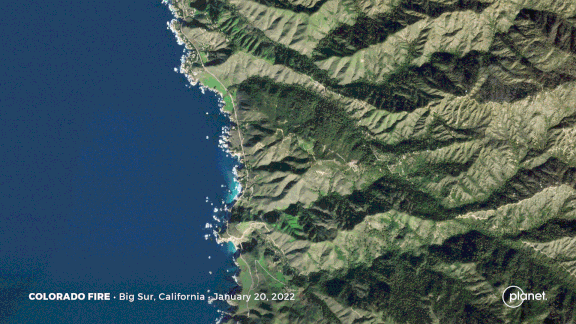
Last weekend, a bush fire near Highway 1 in Big Sur spread along the coast’s hills and canyons.
The blaze moved towards Bixby Bridge, a local attraction popularized by HBO’s Big Little Lies.
But like the mysteries of the show, the conditions of the Colorado Fire are hair-raising: a winter wildfire after months of record-setting rain is a disturbing notion.
|
|
|
|
|
|
|
|
|
