|
|
|
|
|
|
|
|
January 26, 2023 | ISSUE 60 |
|
|
 |
PlanetScope (background) & SkySat (detail) • Tailing pond failure, Jagersfontein, South Africa • September 12, 2022 (background) & September 16, 2022 (detail) |
In this week’s issue: Tip & cue workflows enhance satellite captures; an iceberg the size of London splits off Antarctica; and a strange ship is spotted in Hong Kong.
Having trouble viewing images? Then read this issue on Medium!
In case you missed it last week: Want to make our editor’s day and help improve Snapshots while you’re at it? Then fill out this 30-second feedback poll!
|
|
|
|
|
FEATURE STORYTip & Cue
It may sound like a billiards reference, but the tip & cue process is more like a one-two punch in boxing. It’s the remote sensing world’s signature move, combining different satellite constellations to overcome two grand challenges: scale and resolution. How do you know where to look when you’re scanning the Earth every day? And once you know, how do you get close enough to see the full picture?
Broadly speaking, tip & cue is the process by which one high-frequency satellite constellation can detect (or tip) a change over large areas, then cue a higher-resolution satellite for a closer look. Think of it like a security camera sweeping the room until it senses movement, then zooming in. Or our eyes passively scanning thousands of bits of information at any given moment, but choosing to focus on only those most relevant. And like our eyes, the most noticeable objects in a field of view are the ones that change.
|
 |
Basemaps & SkySat • Building change detection, Saudi Arabia • November 2020 |
Put simply, daily imagery tips a change: |
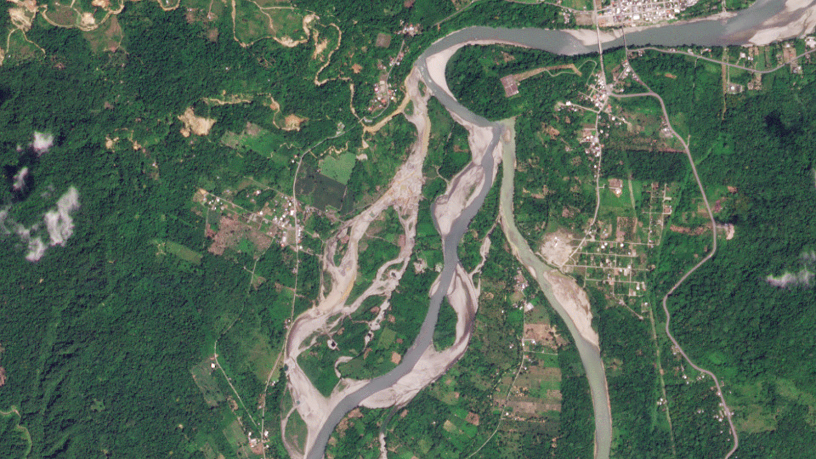 |
PlanetScope • Mining in Yutzupino, Ecuador • December 2, 2021 - January 11, 2022 |
And now with coordinates set, it cues the high-resolution satellite to take a closer picture. |
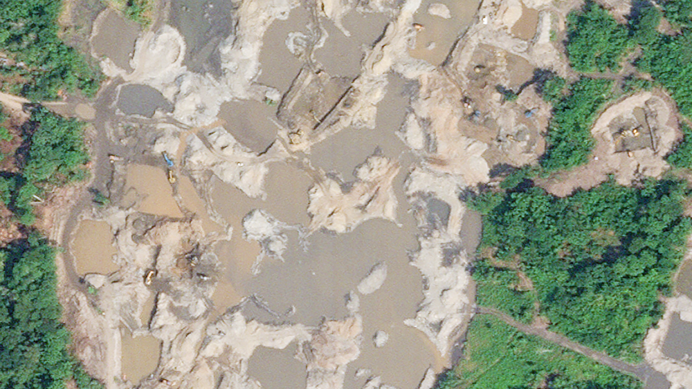 |
SkySat • Mining in Yutzupino, Ecuador • January 17, 2022 |
Pop quiz: can you enhance images like detectives do in Hollywood movies? If you answered yes, go ahead and try it. You’ll have about as much success as making a telescope with just your hands. Tip & cue workflows sidestep the “enhance resolution” problem by leveraging higher-resolution satellites to do the enhancing for them. A 3m/pixel satellite (like our Dove satellites) may be able to detect ships harboring in the jaws of Whitsun Reef… |
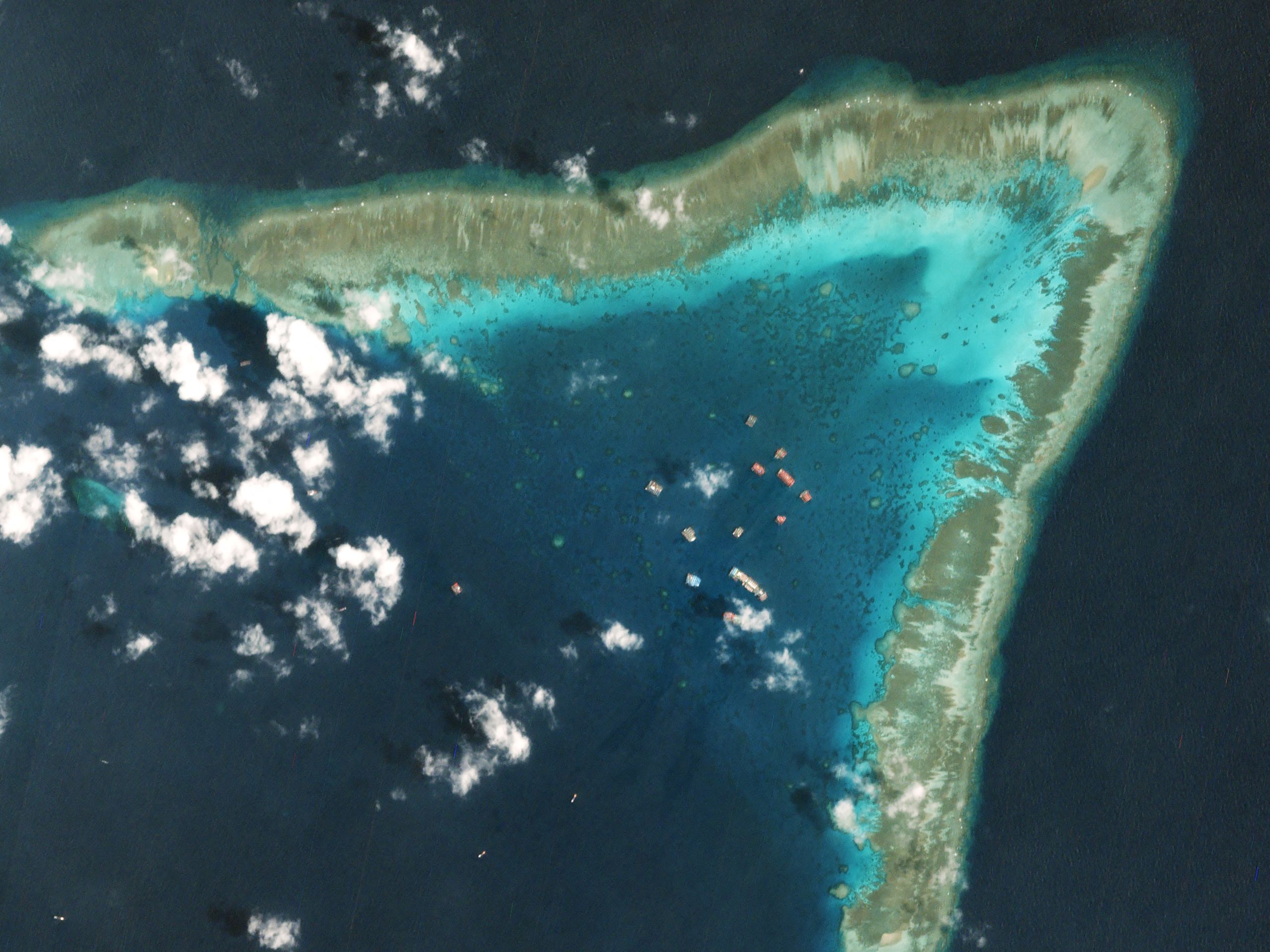 |
PlanetScope • Whitsun Reef, South China Sea • March 20, 2021 |
But they can’t give you the detailed insights that 0.5m/pixel satellites (like SkySat) provide. |
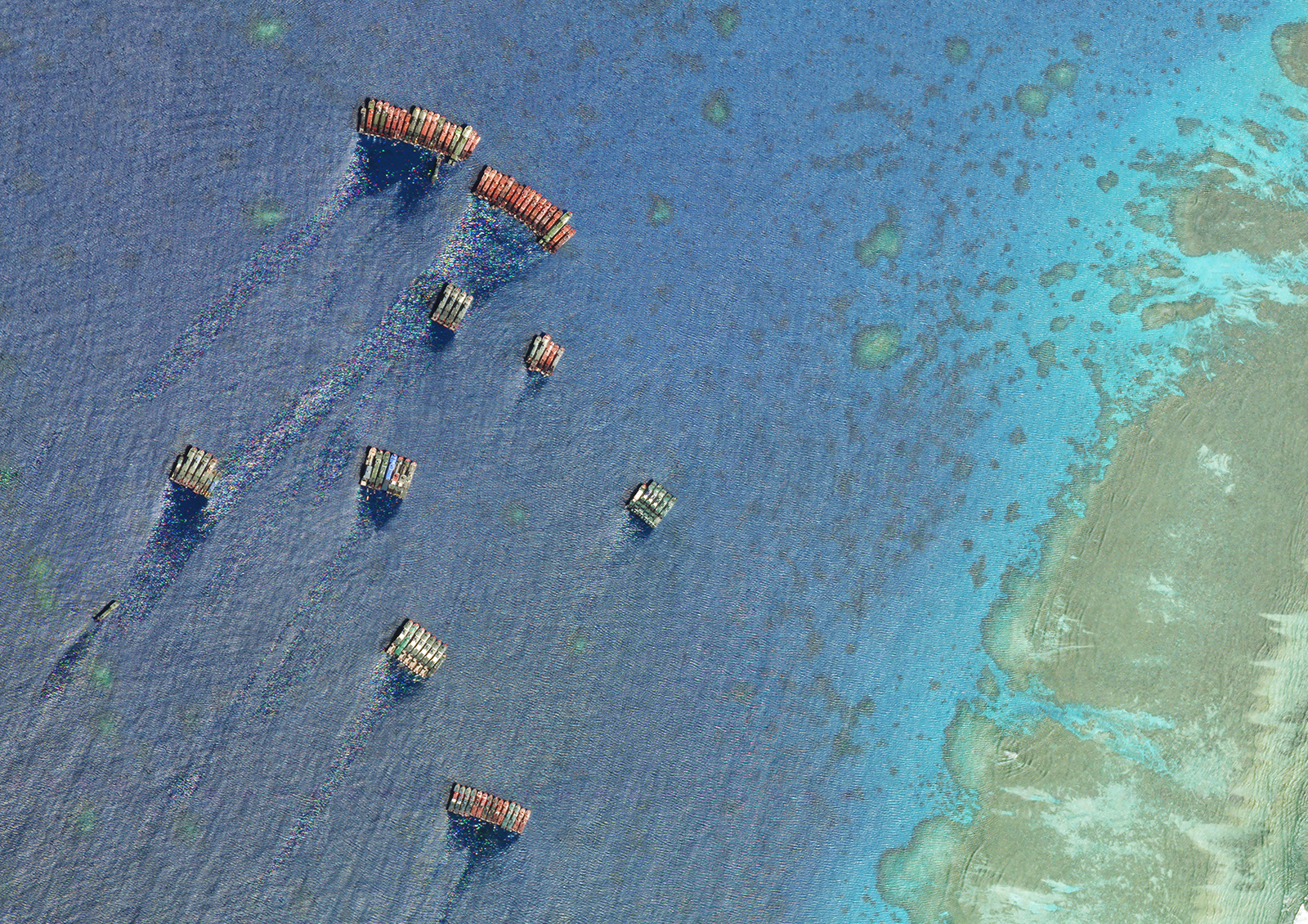 |
SkySat • Whitsun Reef, South China Sea • October 21, 2021 |
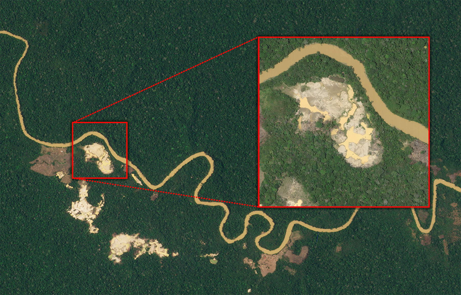
Let’s step back and consider the Amazon Rainforest, all 2.7 million sq. miles (6.9 million sq. km) of it. The task of monitoring its entirety for any changes—road clearings, deforestation, mining, fires—may seem impossible. But a small team of researchers can effectively do this by having one constellation of satellites tip them off to a change, then cue another to take a higher resolution picture. |
 |
|
PlanetScope (background) & SkySat (detail) • Pariamanu River, Peruvian Amazon • October 8, 2020 (background) & October 23, 2020 (detail) |
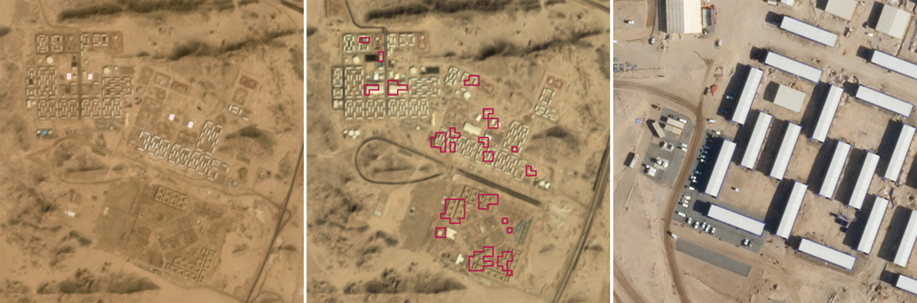
Sometimes the problem with space isn’t its expanse but its location. Some places are harder to keep tabs on for political reasons—but these tabs contain vital information. Knowing the nuclear capabilities of other countries is good intel. But you can’t necessarily just walk up and confirm that the array of construction sites seen in a Chinese desert are in fact nuclear-tipped ballistic launch facilities. Best to take that closer look from a safer distance. The image below captures a section of desert near Yumen, China, that includes 120 ICBM silos under construction. They’re marked with dots here since they’re too small to be seen at this resolution. |
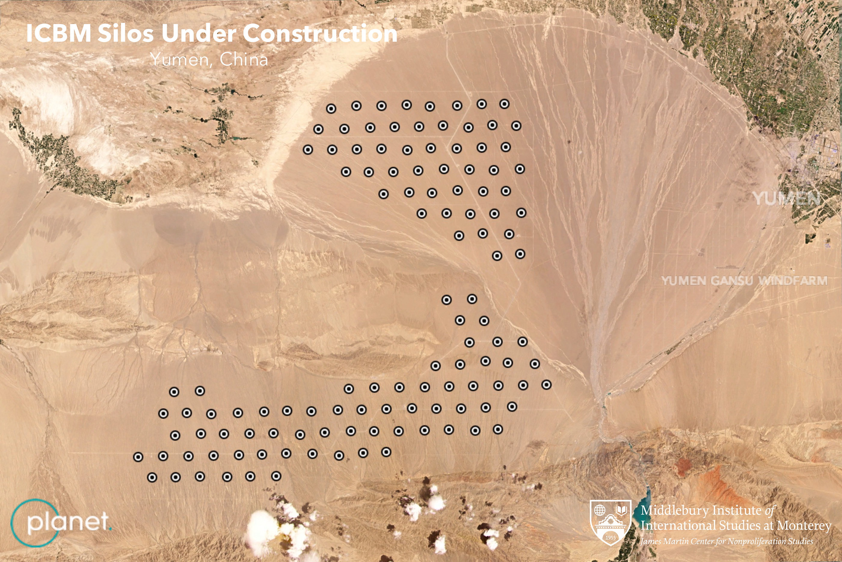 |
PlanetScope data from Planet, Analysis and annotation by MIIS • June 4, 2021 |
But in the following image we’ve zoomed in with a high resolution satellite to see exactly what each of the dots represents—environmental shelters 70 feet (21 meters) wide covering the silo construction sites. |
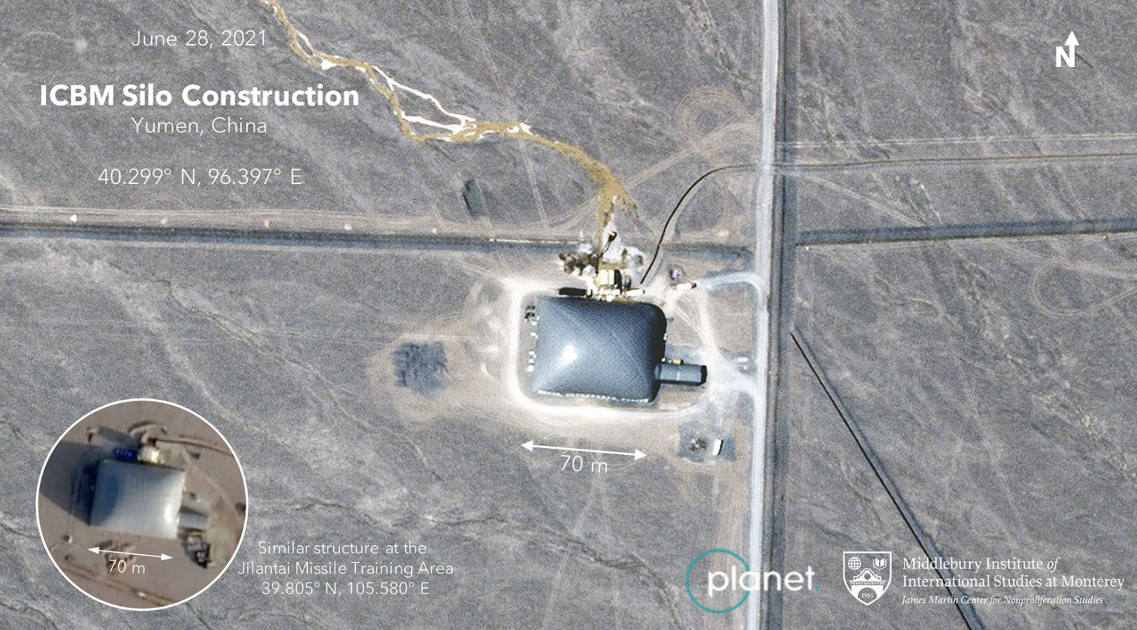 |
SkySat data from Planet, Analysis and annotation by MIIS • June 28, 2021 |
So, passive monitoring allows small teams to keep track of huge areas, eliminating spatial difficulties and overcoming the “enhance” problem. But there’s a third variable it also helps with: time. A lot of tip & cue workflows are automated. Meaning that when one algorithm spots an event—fire, floodwater, or a new road built—it can automatically cue a high-resolution satellite to take a closer peek. This image was taken after a fire alert from NASA’s FIRMS triggered a SkySat to capture data as it passed over, vastly expediting the workflow. |
 |
SkySat • Brush fires, Kazakhstan • September 11, 2020 |
The New Mexico State Land Office turns to satellites to help monitor the 9 million acres they manage. Armed with high-frequency and high-resolution constellations, they’ve cracked down on hundreds of violations ranging from trespassing to prohibited resource extraction. The result? Preserving healthy land and raising millions of dollars to fund the state’s public schools, hospitals, and colleges. |
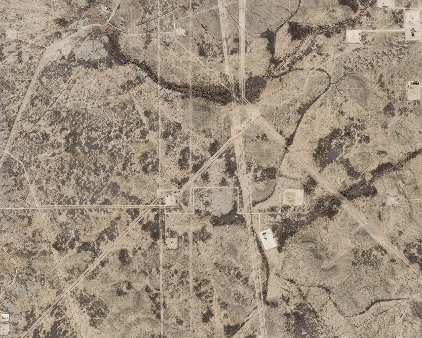 |
SkySat • Right of way development, New Mexico, USA • December 26, 2022 |
The tip & cue workflow takes the best parts of different constellations and adds them together. Throw in some deep learning imagery analytics and you’ve got a one-two remote sensing tool ready for the ring. |
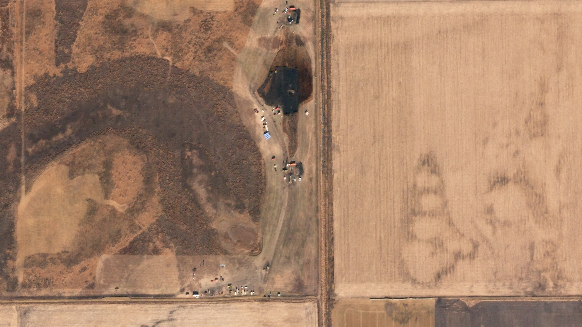 |
SkySat • Keystone Pipeline oil spill, South Dakota, USA • November 21, 2017 |
|
|
|
|
|
|
|
|
|
|
|
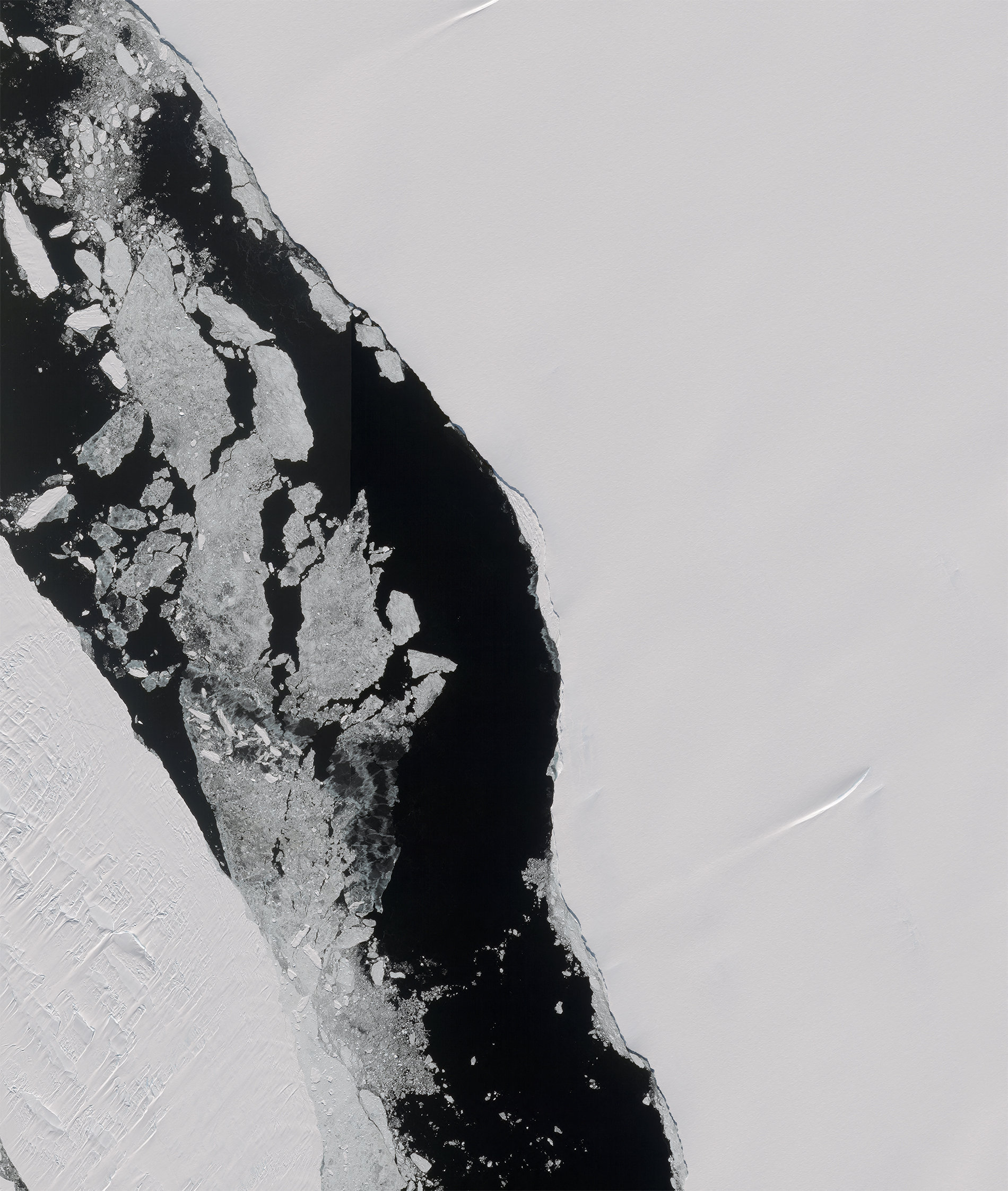
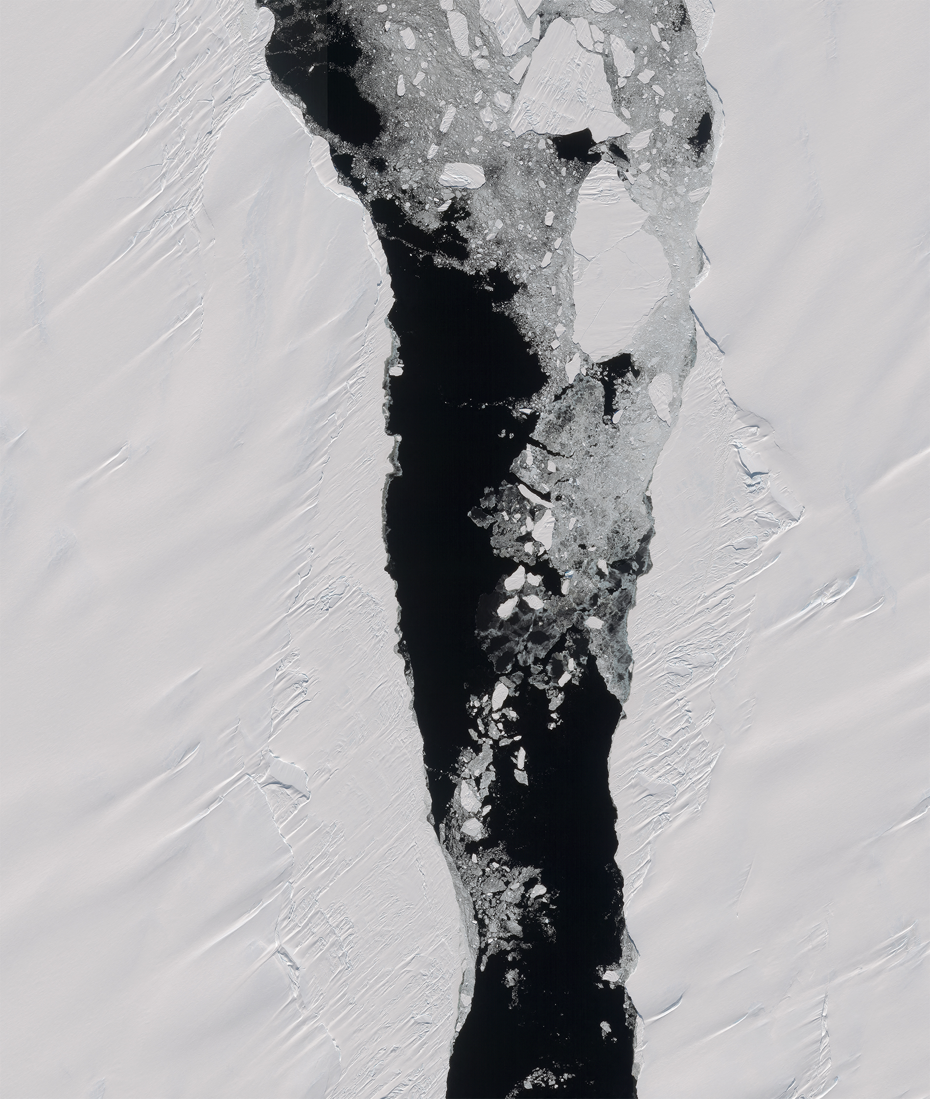
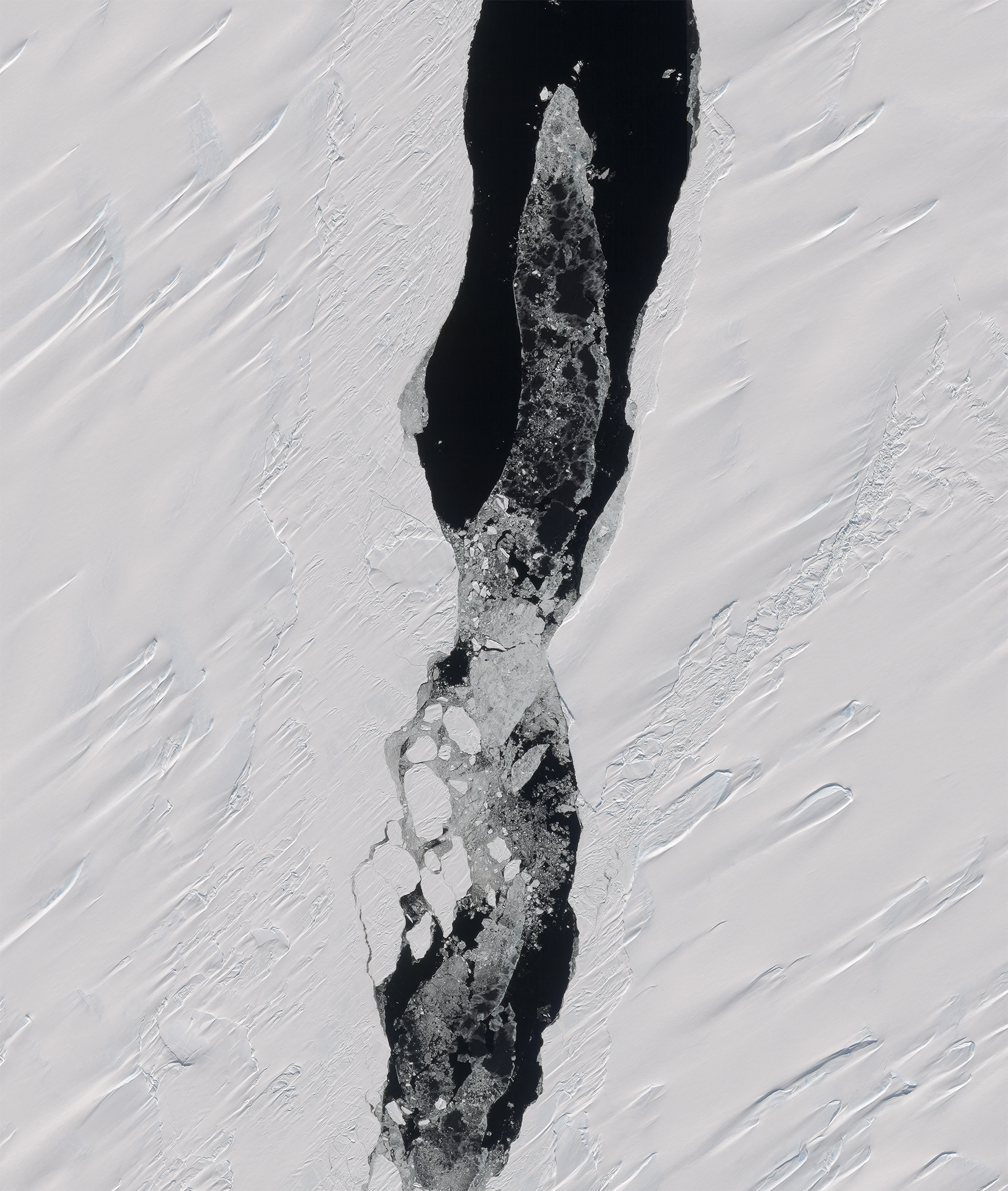
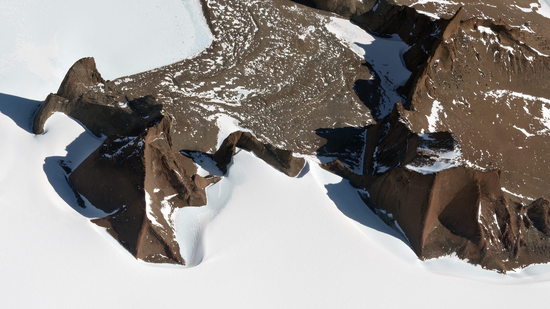
Antarctic Chasm
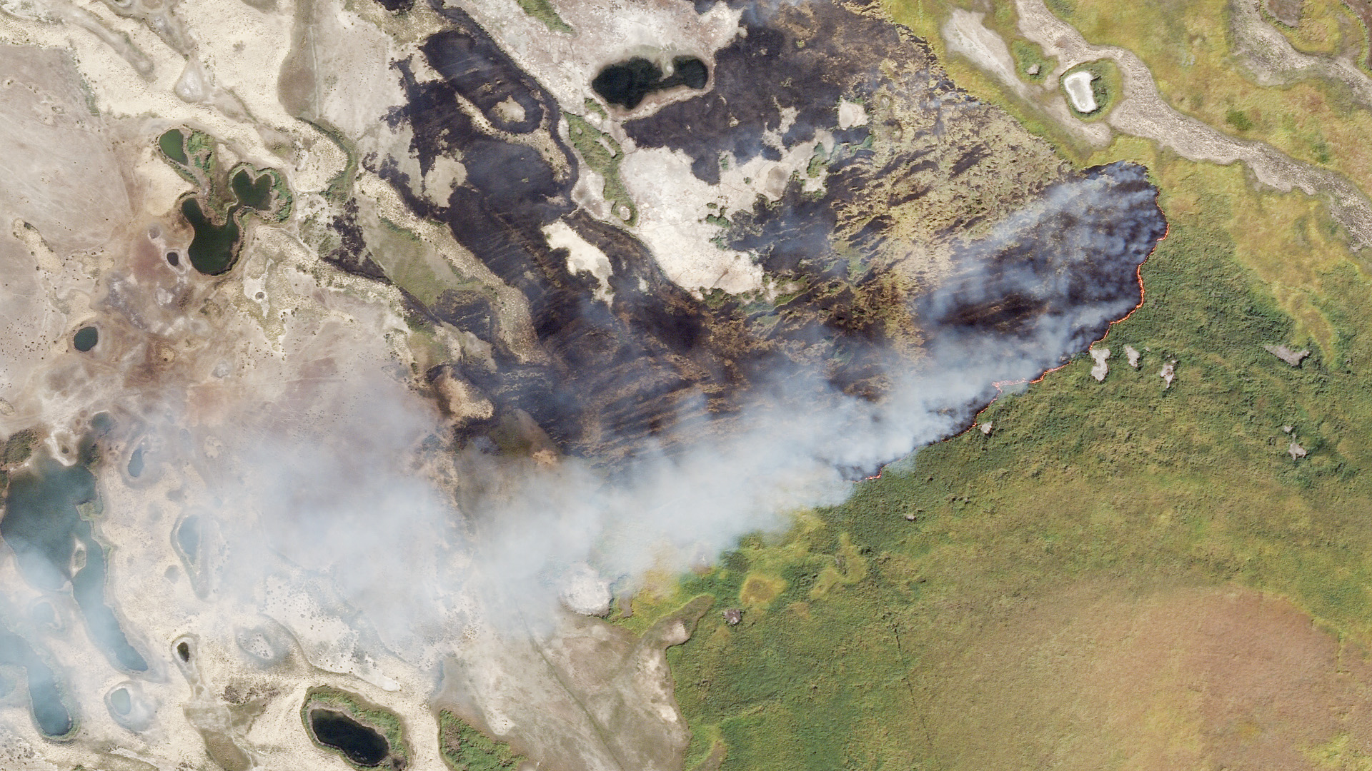
There’s never really any small news stories from Antarctica, and this week’s headline was no exception. An iceberg the size of London broke off from the Brunt Ice Shelf on Sunday near the Halley VI Research Station. Don’t worry though, like Pete Davidson and whoever he dated last, the split wasn’t a surprise. Plus climate change isn’t a factor. The iceberg is too big for our satellites to image it in its entirety, but we captured this section of Chasm-1—the primary break in the shelf—after the iceberg (left) broke away.
|
 |
 |
 |
 |
 |
SkySat • Chasm-1, Brunt Ice Shelf, Antarctica • January 24, 2023 |
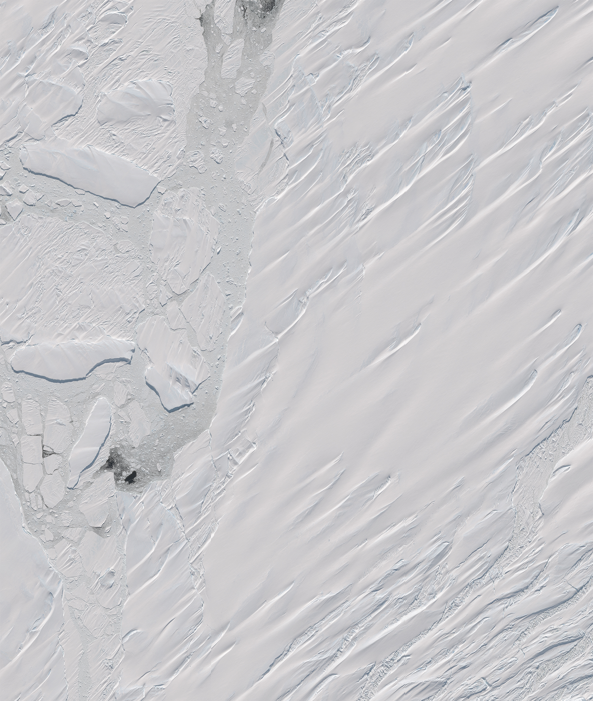
And since we love images from the icy southern pole so much, we’re including this whipped-cream-covered-mousse-looking landform as a cherry on top. They’re actually the Queen Maud Mountains, but they’re no less visually delicious. |
 |
SkySat • Queen Maud Mountains, Antarctica • January 9, 2023 |
|
|
|
|
|
What in the WorldGrounded Ship
Can you spot the building that’s not like the others?
Strip mall ship mall on the seashore. Sorry about that, we saw an opportunity and took it. Much like Hong Kong developers did with The Whampoa: a high-end shopping mall in the shape of a cruise ship to commemorate the area’s past as a busy shipyard. It’s not a real ship though, so it won’t take you anywhere besides a few pegs down on your bank statement.
|
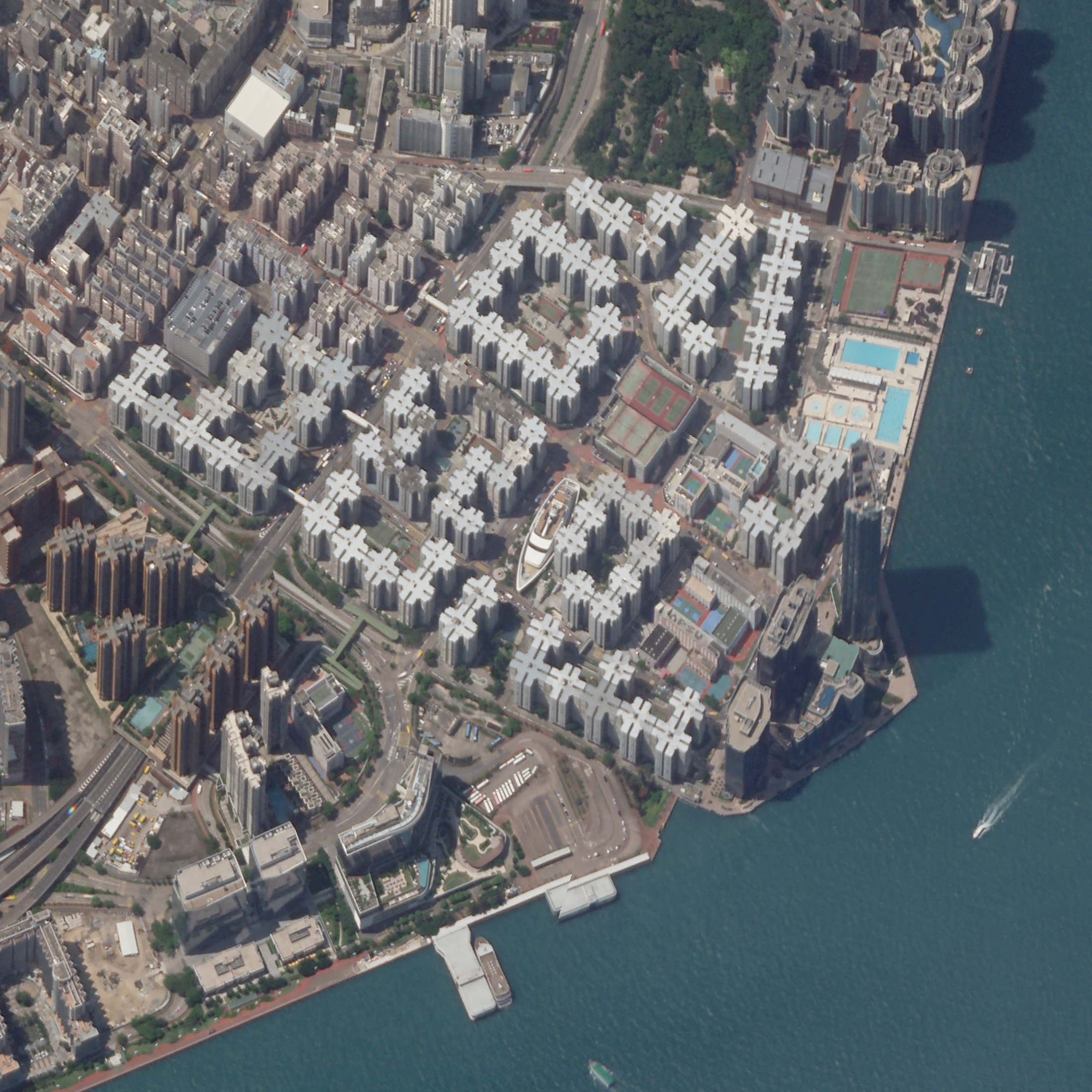 |
SkySat • The Whampoa, Hong Kong • May 20, 2022 |
|
|
|
|
|
Weekly Revisit
Last week we waded into the murky waters of California’s flooding at the end of weeks of atmospheric rivers. The whole issue was basically a “change of the week” section, so if you like those be sure to check it out and take a look at the whole archive if you’re extra curious.
|
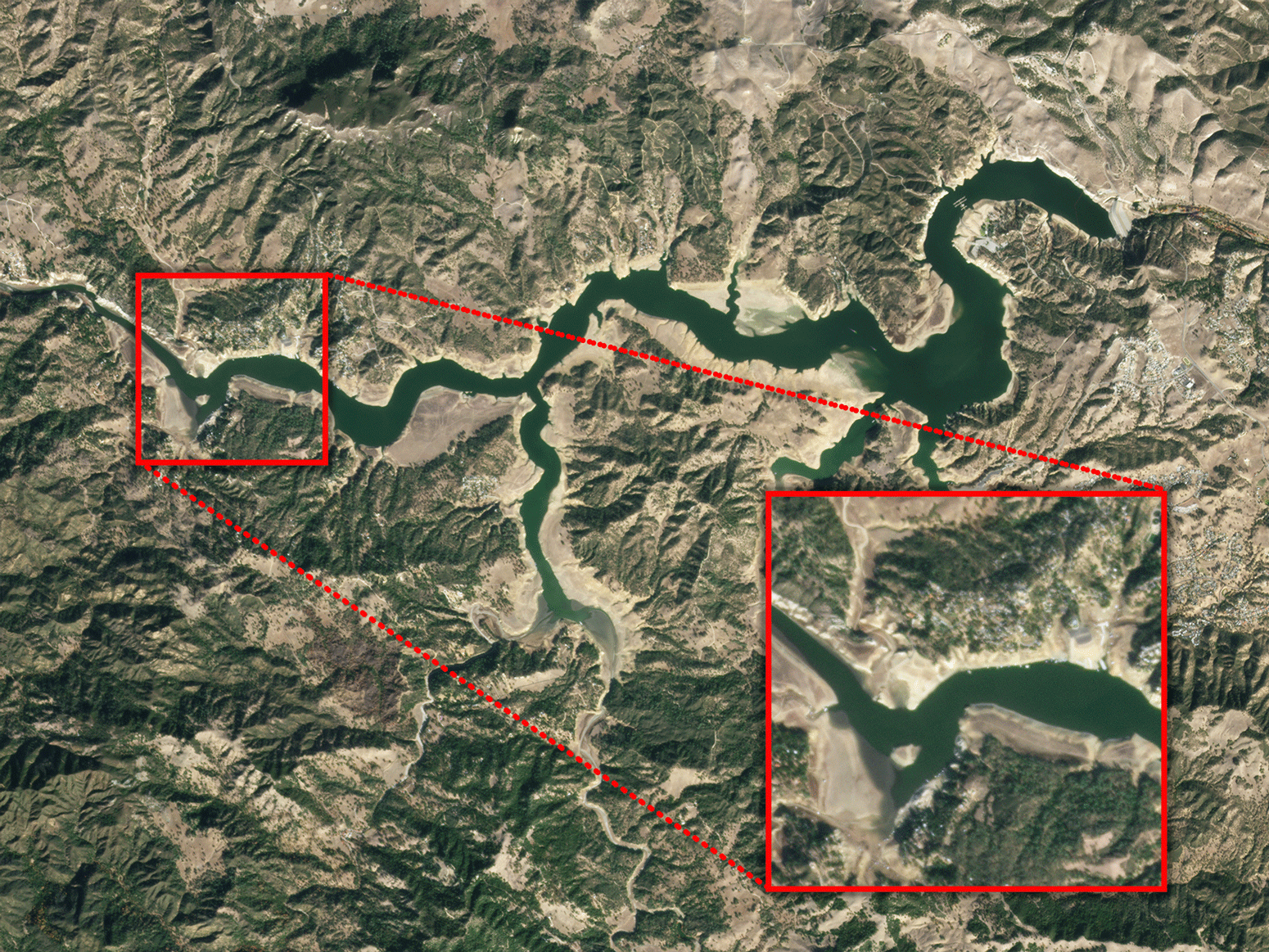 |
PlanetScope • Lake Nacimiento (aka Dragon Lake), San Luis Obispo County, CA • November 25, 2022 - January 16, 2023 |
|
|
|
|